
WindBorne Systems successfully navigates a weather balloon into the eye of typhoon Dolphin
Demonstrates the promise of cutting edge atmospheric observational systems. In the current tropics, Dolphin remains the main game in town.
Time for a weekly look at the tropics — and before I get too deep into what is happening out there, I want to take a look at a very cool tropical related science story.
Private meteorological firm WindBorne Systems has been doing some fascinating and cutting-edge work in recent years using long-duration weather balloons — balloons that stay airborne and collect data for days to weeks instead of the hour or two that traditional weather balloons fly — to collect upper-air data from across the globe. Over the weekend, WindBorne did a first of its kind mission to direct one of their Global Sounding Balloons (GSB) into the eye of Super Typhoon Dolphin to gather real-time data from the core of this intense tropical cyclone.
WindBorne’s balloon made several ascents and descents through the eye and eyewall of Dolphin over a several hour period Saturday morning (US time). Senior Scientist Dr. Larissa Reames noted on Bluesky that the balloon’s instrument measured a maximum 1-minute wind of 135 knots at 946m above MSL, and potentially descended as low as 8 meters above the ocean surface.
WindBorne has a number of balloons airborne at any one time, gathering data which it uses as input into it Weathermesh-6 AI/deep learning weather prediction system. While there has been a lot of (deserved) scrutiny of the NWS upper air balloon program due to numerous issues in recent months, private companies like Windborne as well as academic and research institutions have been developing new observational capabilities such as these long-duration balloons to help provide the next generation of upper air meteorological observations.
NOAA is receiving funding from Congress through the National Mesonet Program (NMP) to work with these entities and potentially bring this data into the public weather sector. In fact, through NMP, NOAA is ingesting WindBorne’s real-time GSB data into its Global Forecasting System (GFS). So even while the NWS struggles with current upper air observational capacity, these new systems are moving forward as potential long-term solutions to provide a better and more continuous picture of the atmosphere than we have had in the past.
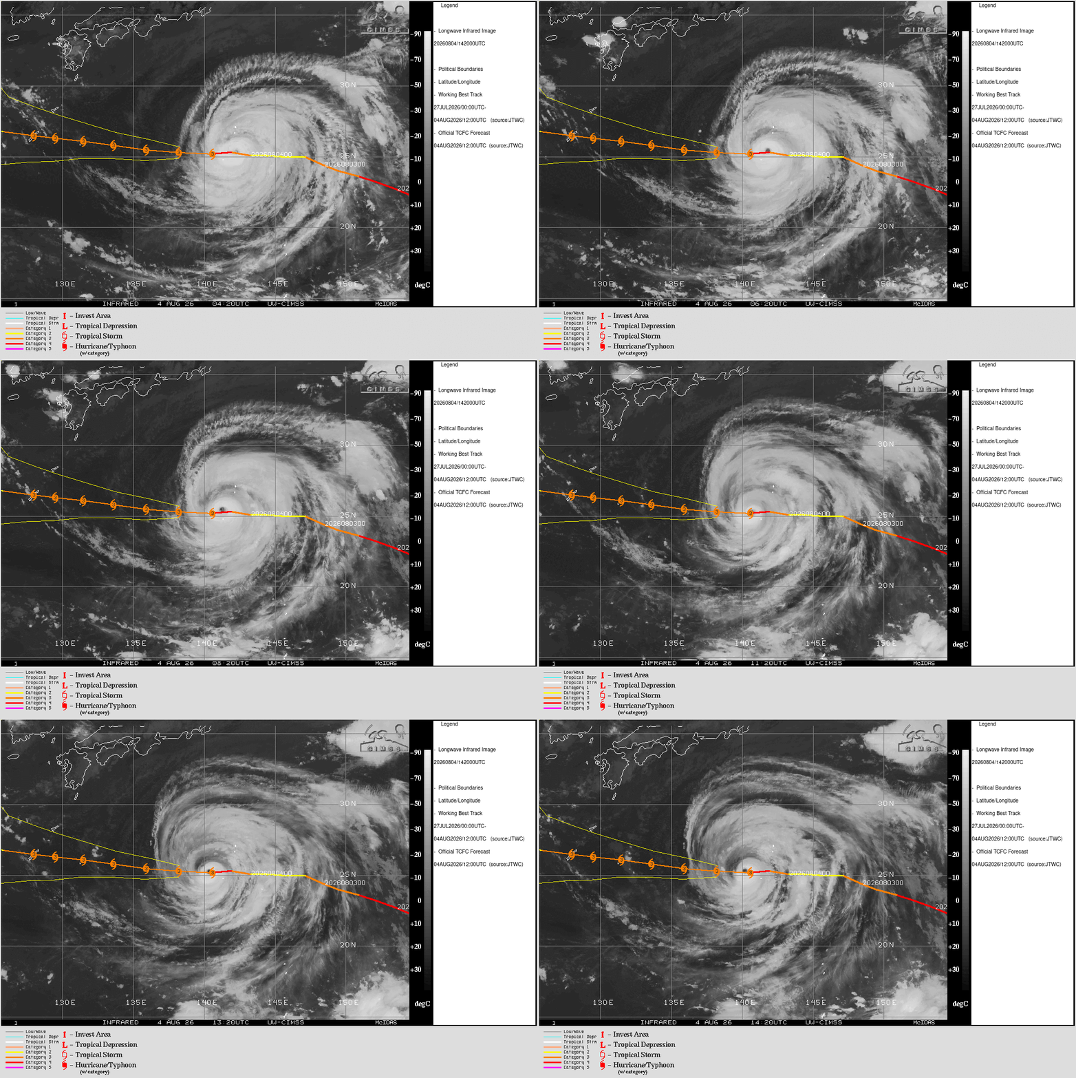
Dolphin remains the main game in the global tropics today. The cyclone has been through several eyewall replacement cycles and associated changes in intensity. Currently, the Joint Typhoon Warning Center estimates that Dolphin has maximum sustained winds of 125 mph as it moves just north of due west in the general direction of Okinawa.
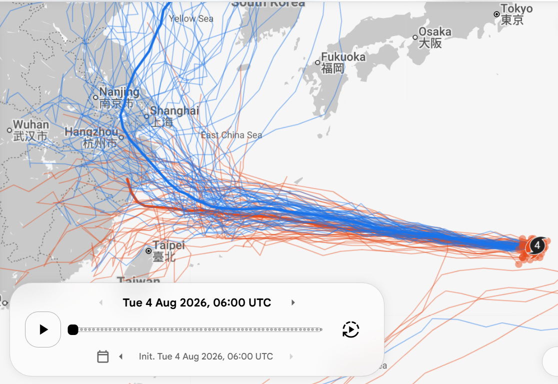
The models are in general agreement (Google DeepMind tracks shown above in blue, European ensemble in orange) that Dolphin will pass near or over Okinawa and then continue to move generally west for a few more days before a gradual turn more toward the northwest as the cyclone approaches the Yellow Sea and mainland China. There is still uncertainty about how soon and sharp that turn will be, and where ultimately Dolphin will make landfall.
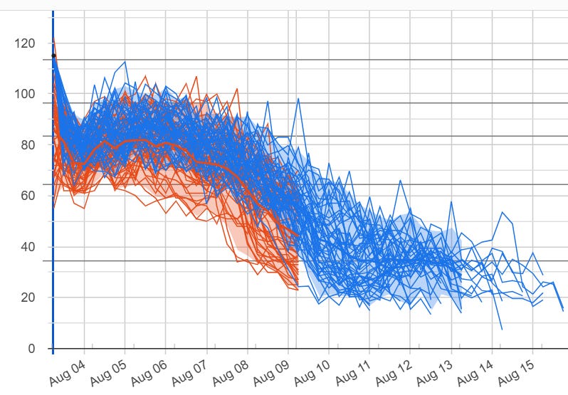
Dolphin is definitely past its peak as far as intensity is concerned. As we have been discussing, it should expand in size as it continues to gradually weaken over the next several days. The expansion of the windfield means that even though Dolphin will not be nearly as intense as it was over the last several days, Okinawa will likely see a prolonged period of tropical storm and typhoon strength winds.
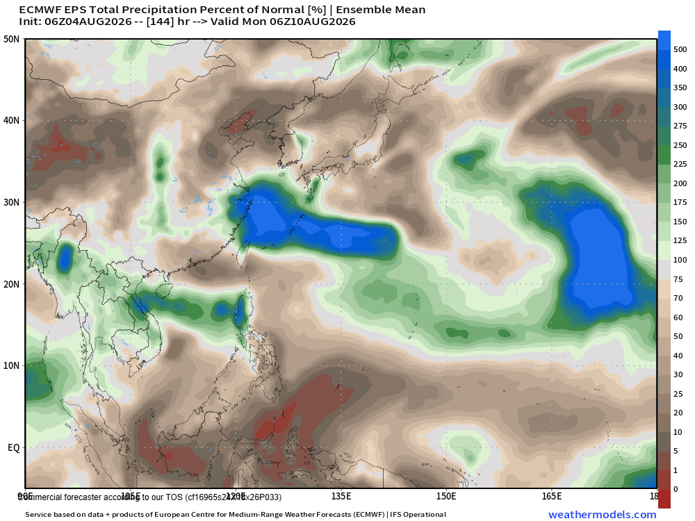
The combination of a tropical depression in the area and Dolphin passing to the north is expected to bring very heavy rainfall to northwestern parts of the Philippines over the next several days which could cause flooding concerns.
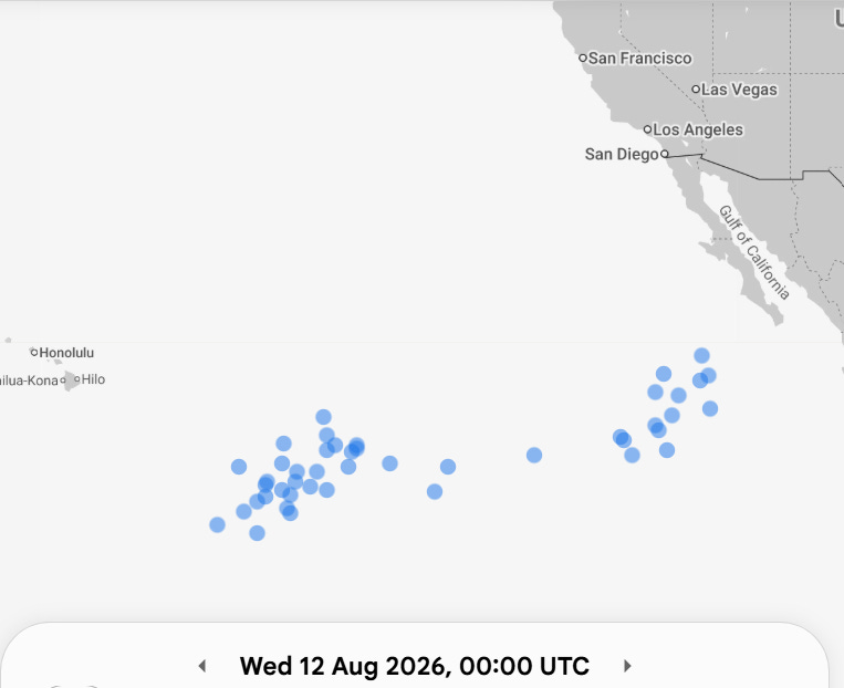
The eastern Pacific and Atlantic are currently quiet and should remain that way through this week. The models show an increase in tropical cyclone potential in the Pacific next week — including the potential for a new system southeast of Hawai’i. At this time range, of course for now this is just something to watch.
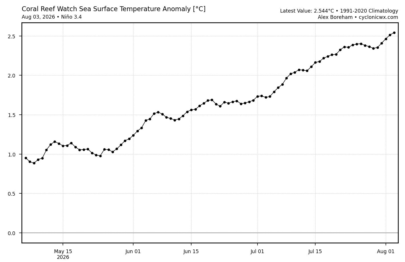
The Atlantic continues to look completely dead as we head through the first half of August. El Nino continues to intensify and the sea surface temperature anomaly in the critical Nino3.4 region has now exceeded +2.5C — well above the 1.5C threshold for a strong El Nino. NOAA will be releasing its early August update to their seasonal hurricane forecast soon — and given the trends of the ever strengthening El Nino and stronger than normal wind shear across the tropical Atlantic so far this season, I would expect that the probabilities for a below normal season will be increased even further.
Programming note: I am posting semi-regularly again — but family commitments and travel after the passing of my mom will mean those posts will not be as frequent or consistently timed as they typically have been.
Balanced Weather is made possible by the generous support of paid subscribers, who as thanks get access to live Balanced Weather chats and videos as well as the ability to post comments and ask questions on posts. To become a paid subscriber or a free subscriber (also very much appreciated and you will automatically receive new posts in your email), please click below.