


Tropics continue to be busy
New tropical storm in the Atlantic, unusual hurricane in Pacific
Since today is Monday — the day I normally do a weekly tropical newsletter — and the tropics would be the big focus of today’s regular newsletter anyway, I’m going to combine them again this week. I’ll focus on the tropics for much of this post, but will include a short update about “other weather” at the end.
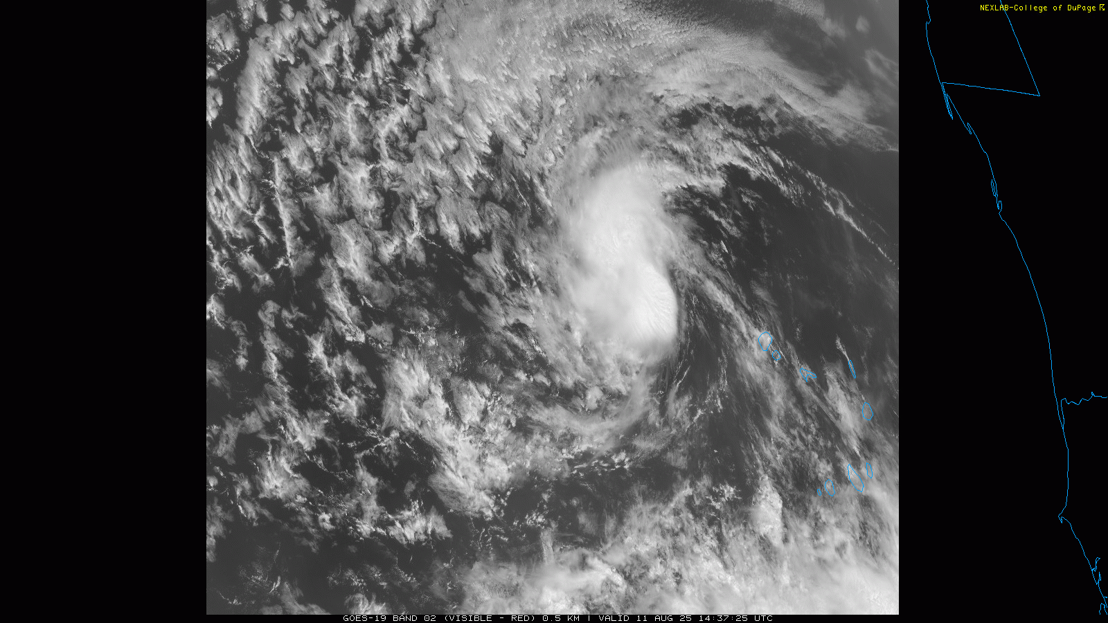
In breaking news, the National Hurricane Center has just started advisories on Tropical Storm Erin, which has formed in the far eastern Atlantic just west of the Cabo Verde Islands off the coast of Africa. Erin looks decent in morning visible satellite imagery, with a well defined circulation, and microwave satellite data showed forecasters this morning that it contains winds up to 45 mph.

Over the next couple of days, Erin will be moving through some rather dry atmospheric conditions, and given that it is a very small storm at this point, it seems unlikely to strengthen much. After that time, though, it will be moving into more favorable conditions and there is good model agreement that Erin will intensify into a significant hurricane. The NHC forecast explicitly shows Erin as a category 3 major hurricane to the north-northeast of the Leeward Islands by Saturday at the end of its forecast.
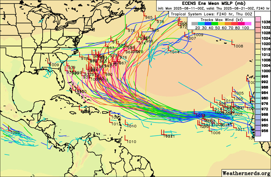
Beyond that time period, there is now strong model consensus (European ensemble tracks shown above) that Erin will begin to turn more northward into a weakness in the subtropical ridge. While it is of course still way too far out to say anything with certainty and we will need to keep close tabs on it, at this point it seems unlikely that Erin will be a threat to the mainland United States, with Bermuda being the most likely inhabited area to have any concern with this potential hurricane.
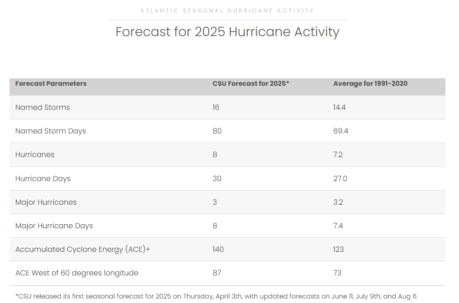
As far as the bigger picture for the Atlantic hurricane season, the Colorado State University and NOAA forecast teams both issued their final updates for the 2025 season and continue to indicate a somewhat above normal season. If Erin does actually develop as robustly as the current forecast shows, having an intense hurricane form from in the area of the Atlantic main development region this early in the season would ordinarily be a hint to me that the atmospheric conditions are indeed rather favorable going into the peak of the season. However, as we have been talking about in the last few weeks, conditions in the Atlantic right now are being helped by a favorable phase of the Madden-Julian Oscillation, so that could be a bigger factor than the overall Atlantic conditions. Regardless, as analyzed by the seasonal outlook science teams, the factors overall support a somewhat more active season.
In the shorter term, other than Erin there does not seem to be a strong indication of another system in the Atlantic over the next 10-14 days. There is some indication in the modeling - particularly the AI based models - of another system in the deep tropical Atlantic behind Erin about 10 days from now, but we have plenty of time to watch that. NHC is monitoring a couple of weak subtropical systems in the north Atlantic but only show low probabilities of development for those.
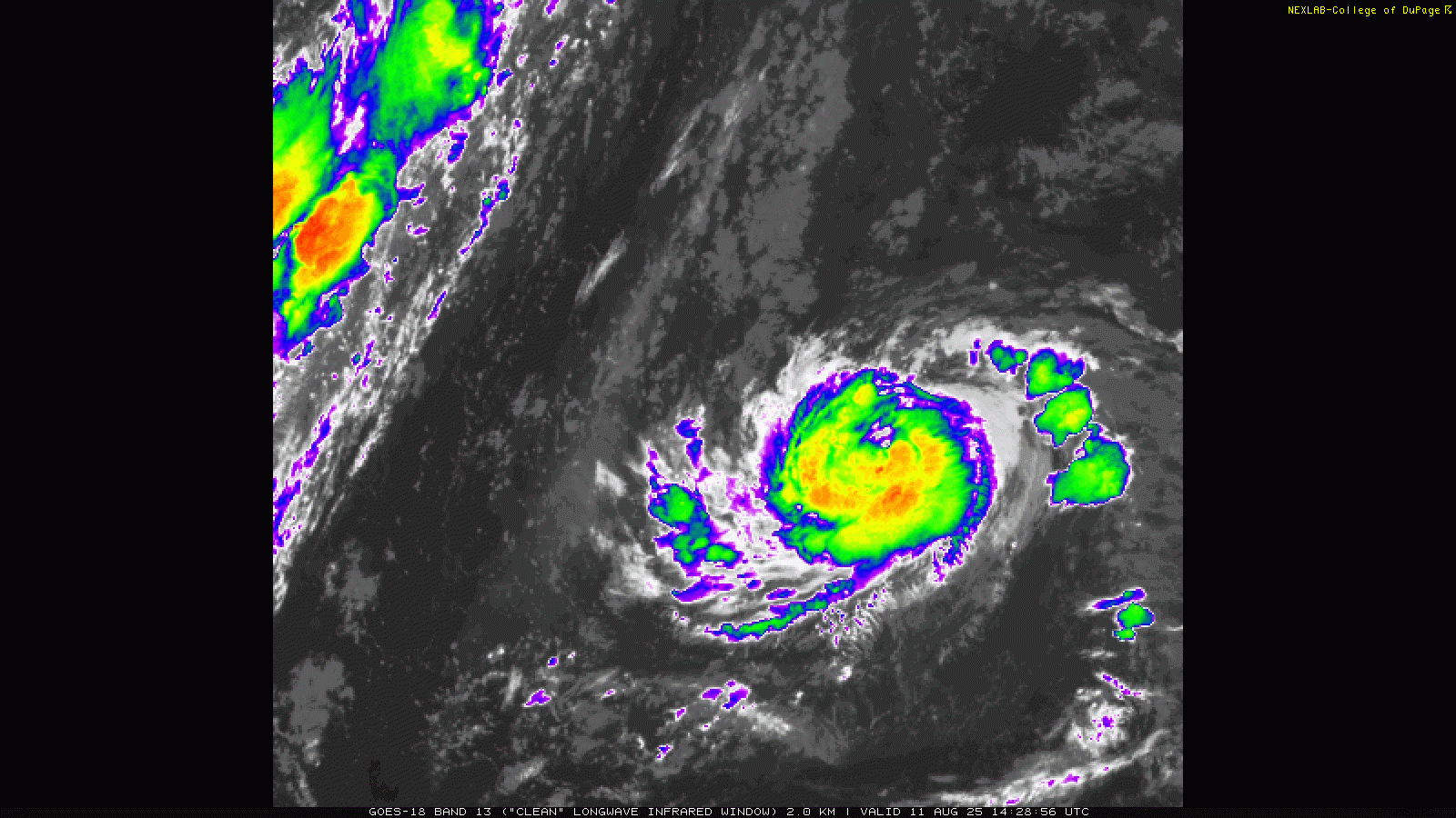
In the Pacific, Henriette intensified into a hurricane yesterday well to the north of Hawaii. Morning satellite imagery shows it continues to become better organized, with stronger thunderstorms developing around the center of circulation.

Henriette is forecast to intensify a bit more today, and remain a hurricane as it approaches 35 degrees north latitude in the subtropical central Pacific. While we see hurricanes in the Atlantic at this latitude rather regularly and it also happens in the western Pacific, it is pretty unusual to see in this part of the Pacific.
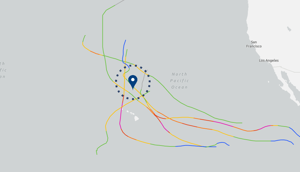
In fact, using NOAA’s historical hurricane track webpage, we can see that there have only been six other tropical cyclones on record within 250 nautical miles of Henriette’s current position. Most of those were intense hurricanes in the tropics that were weakening but still organized systems as they moved north into the subtropics. There have only been 3 other hurricanes are in the database within 250 nmi of where Henriette is now. From what I can see, an unnamed system in August 1957 is the only one of these besides Henriette that first became a hurricane this far north.
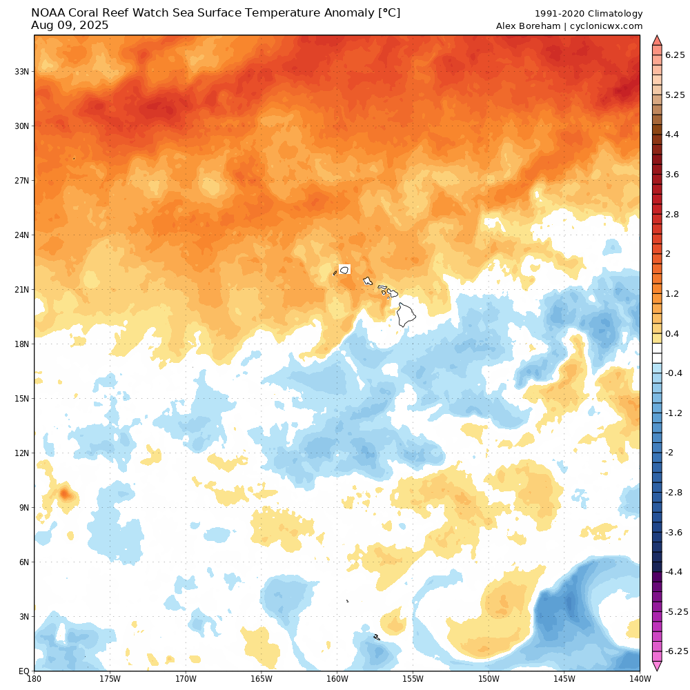
Henriette is assuredly being helped by well above normal sea surface temperatures (SSTs) north of Hawaii as shown in the SST anomaly chart above.
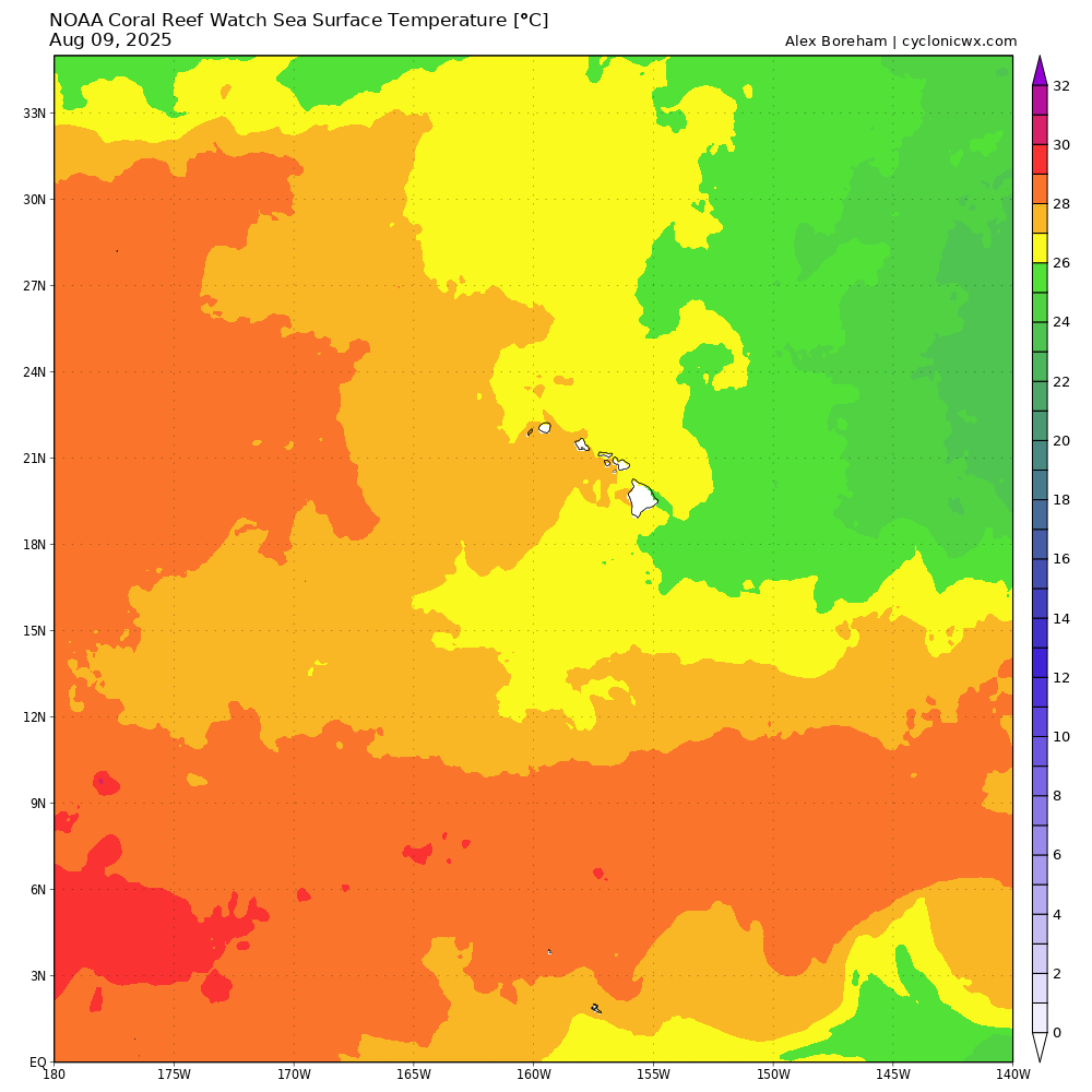
Hurricanes require sufficiently warm water above 26C, and the unusual warmth of the ocean is providing that for Henriette as this SST map from cyclonicwx.com shows.
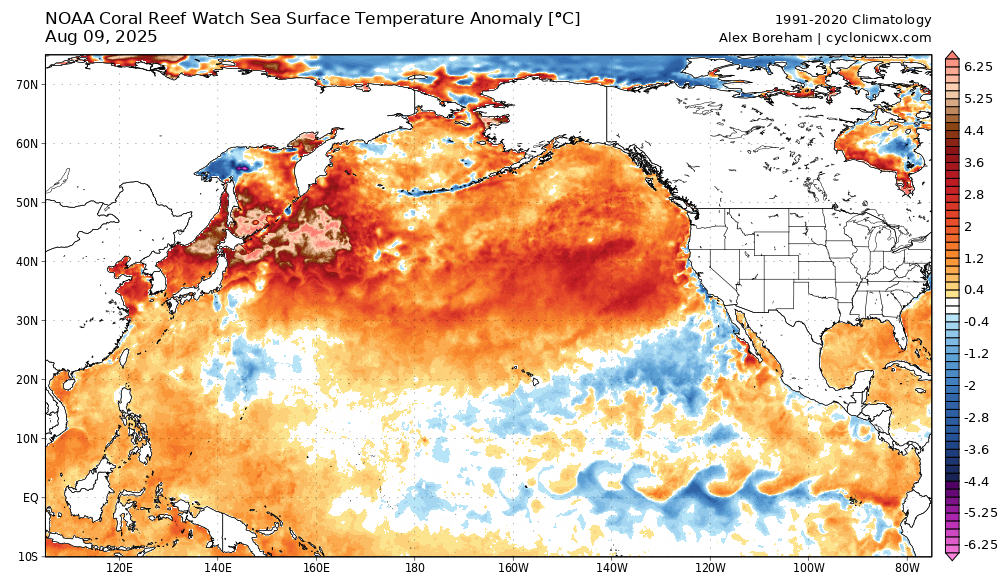
The warmth north of Hawaii is part of a north Pacific wide marine heat wave that has SSTs as much as an insane 5C above normal in the northwest Pacific around Japan; this unusual warmth is almost certainly in significant part due to human-caused global warming. Bottom line — the atmosphere and ocean must respond to the laws of physics and chemistry, and if we alter the background conditions they will respond accordingly. If the water continues to grow warmer around and north of Hawaii, tropical cyclones will be able to maintain themselves more frequently in this region.
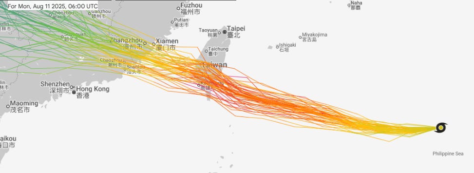
Speaking of the western Pacific, Tropical Storm Podul is forecast to intensity into a typhoon over the next couple of days, and impact Taiwan as the equivalent of category 1-2 hurricane. Taiwan is a very mountainous island that can have major flash flood impacts from landfalling tropical cyclones, so this will be a concern as the system traverses the island midweek.

Coming back stateside, scattered to numerous thunderstorms will be common over the eastern two-thirds of the country, with a few focused areas of flash flooding risk. The largest area will be across the Southern Plains along the slow moving cold front moving across the region. Along the Florida panhandle coast, the weak tropical disturbance we have been talking about the last several days will be passing nearby bringing a focused risk of intense rainfall and some flash flooding. Finally, the old stationary front that has been parked along the Southeast coast for days will continue to provide a focus for thunderstorms and potential flash flooding.
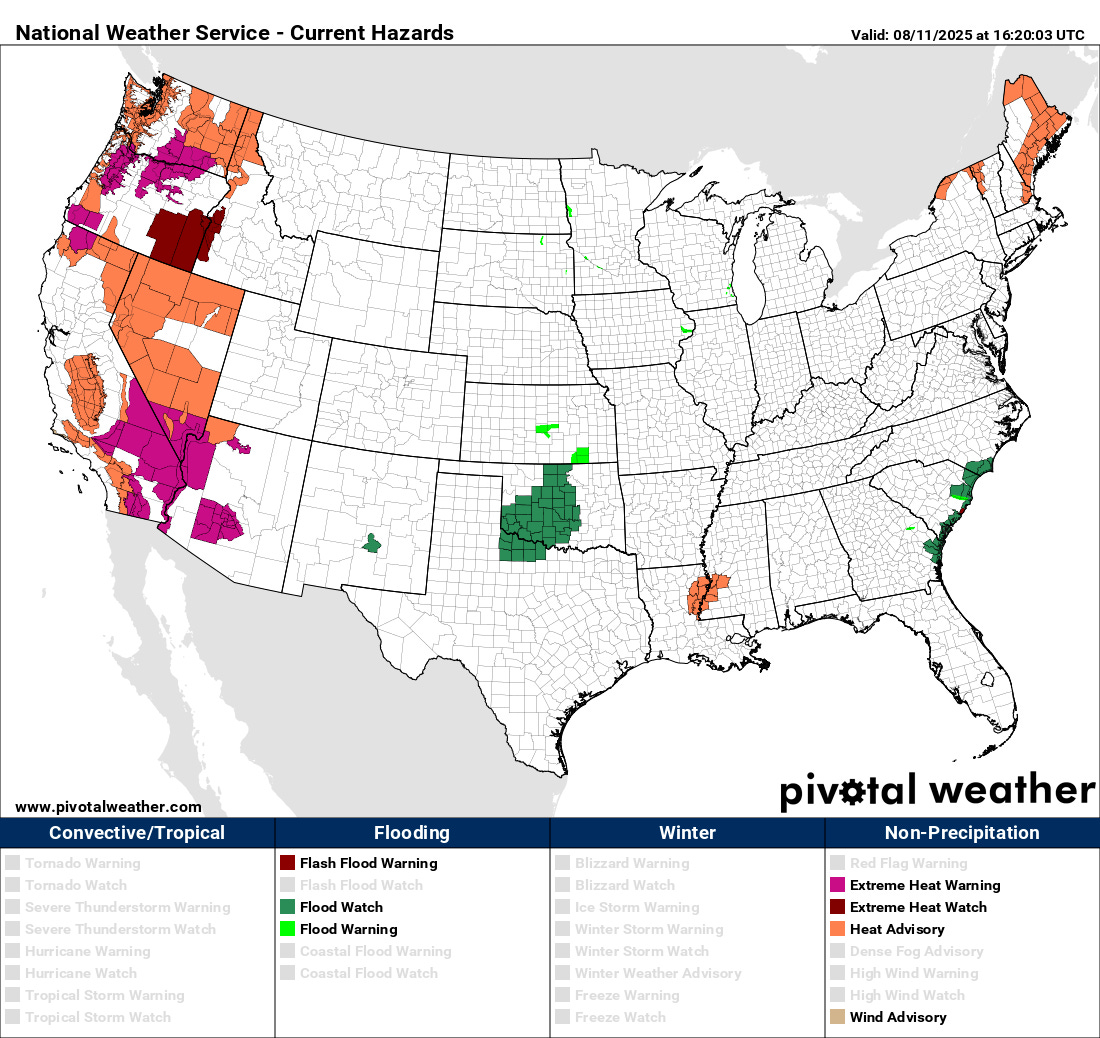
Heat will continue to be a serious risk in the West today, and will also build into northern New England and Maine where heat advisories are in effect and some record highs are possible today.