Tropical Storm Chantal forms
Will bring heavy rain to the Carolinas next couple of days
Note: this is going to be an abbreviated version of the daily newsletter because I think it is important given some of the recent news about the horrific flash flooding in Texas to do a full article on that, which I am going to try to get out by around midday.
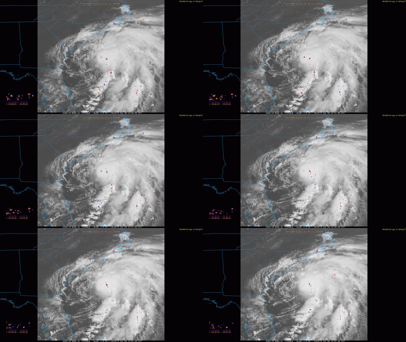
Satellite images this morning showed that Tropical Depression Three was getting better organized - but it is still a lopsided system with most of the thunderstorm activity east of the clear center of circulation. A reconnaissance aircraft just made their first pass through the storm of the morning and found tropical storm force surface winds and that the central pressure of the storm was down several millibars from last night, and based on all of that NHC has upgraded the system to Tropical Storm Chantal.
Given the continued organizing trend apparent in observational data this morning and the most recent hurricane model projections, it seems likely that Chantal will continue to gradually strengthen as it moves north-northwest toward the Carolina coast, and will likely be a 50 to 60 mph tropical storm when it makes landfall in the general vicinity of Myrtle Beach. It will likely remain a lopsided storm though with most of the wind and thunderstorm activity east of where the center makes landfall. Heavy rain and isolated flash flooding - particularly in more urban areas - will occur east of the center, but Chantal does not look like a prolific heavy rain maker like some tropical systems in recent years.
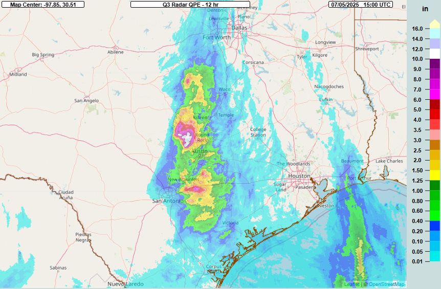
Unfortunately, the atmosphere put on a repeat performance overnight as far as insanely heavy rainfall in central Texas, with an axis running along the I-35 corridor from east of San Antonio to west of Waco. Luckily, the heaviest amounts missed most of the vulnerable urban areas, with an area of more than 15” of rain in 12 hours estimated by radar over the Balcones Canyonlands just west of Round Rock.
The FLASH unit streamflow hydrologic product showed that major flash flooding occurred in this area, and media reports indicate that numerous water rescues were taking place earlier this morning.
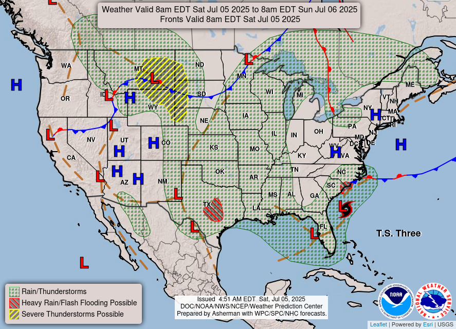
Additional flash flooding is possible in central Texas through tonight, but it does look like the overall risk should gradually be decreasing. For the rest of the country today, scattered to numerous thunderstorms are expected over the Southeast and through the central third of the country. A enhanced (level 3 of 5) risk of severe storms is in place for southeast Montana and adjacent parts of Wyoming and South Dakota for the expectation of an evolving cluster of severe storms capable of very large hail and significant damaging wind gusts. A large slight risk surrounds the enhanced risk area as shown above.


![[Key Messages] [Key Messages]](https://substackcdn.com/image/fetch/$s_!wdsx!,w_1456,c_limit,f_auto,q_auto:good,fl_progressive:steep/https%3A%2F%2Fsubstack-post-media.s3.amazonaws.com%2Fpublic%2Fimages%2Fed1018d0-5410-4d30-a64e-029798fe3a7f_897x736.png)


