
The Omega Block Cometh
Finally, a welcome wet pattern for the Southeast but also watching for flash flooding.
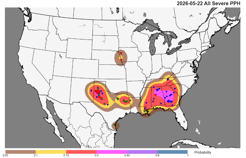
While not nearly the magnitude or coverage of severe weather that we saw in the central US earlier this week and last week, the last 24 hours were relatively busy with regard to severe storms. In the Southeast, an almost tropical sort of severe weather setup with a very moist and somewhat unstable atmosphere combined with relatively strong wind shear in lower levels of the atmosphere to produce a number of low topped rotating supercell storms. These storms produced some straight line wind damage and a few tornadoes, including this one that crossed Interstate 20 east of Tuscaloosa, AL. Meanwhile, in the Southern Plains more traditional supercell severe storms produced several tornadoes and large hail up to baseball sized.
Farther east, scattered overnight thunderstorms organized into a quasi-linear convective system (QLCS) that has been producing incidences of damaging straight line wind as it moved across far east Texas and western and central Louisiana. More than 50K customers are without power in this region due to these storms.
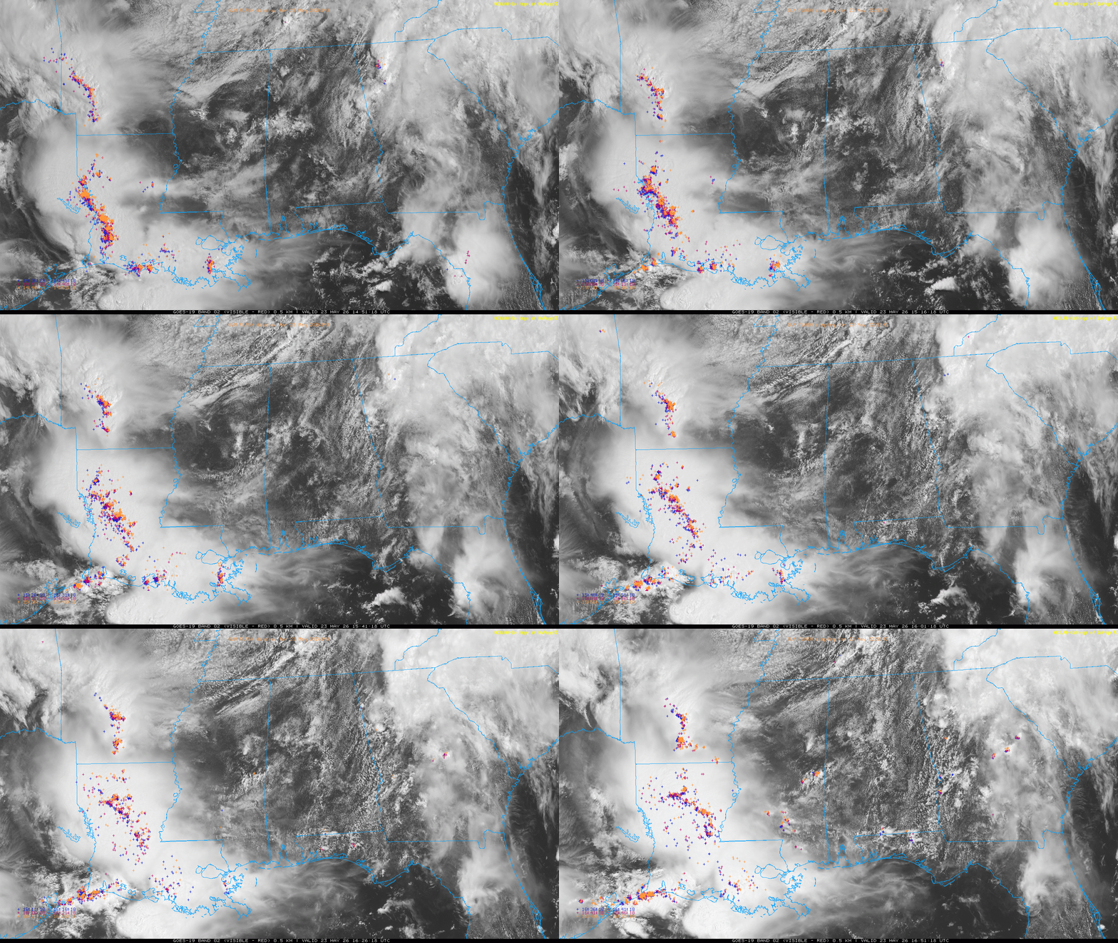
As these storms move northeast into a very moist atmosphere that will see a boost in instability due to daytime heating, the storms should be able to maintain a severe weather threat, and a severe thunderstorm watch is in effect for the Arklamiss region this afternoon.
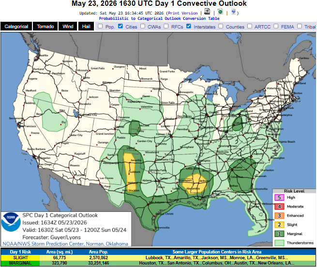
A slight (level 2 of 5) risk of severe storms is also in place for the west Texas High Plains were scattered afternoon/evening storms may produce some incidences of large hail and damaging winds.
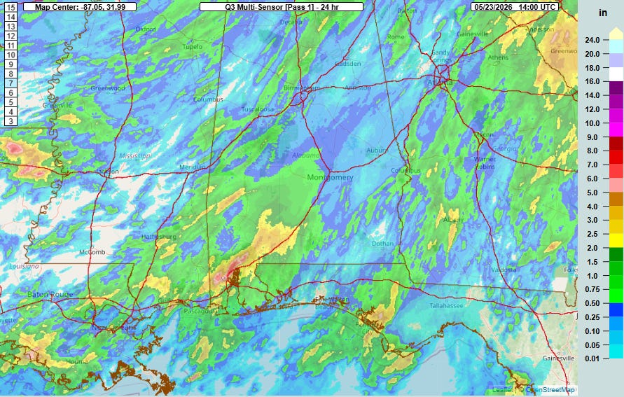
The thunderstorms over the South have also been producing very heavy rainfall, particularly along the central Gulf Coast where training thunderstorms produced some flash flooding in the Mobile Bay region on Friday.
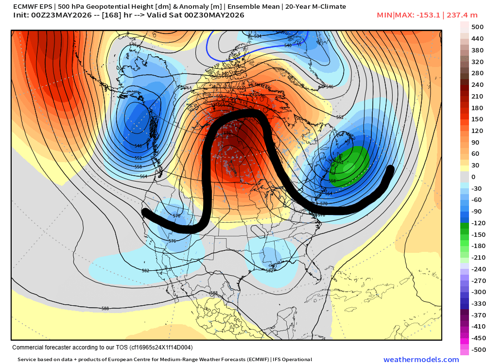
Heavy rain and flash flooding risks will be continuing in the South the next several days as the upper air weather pattern across North America moves toward an “omega block” pattern — so called because the 500 millibar pattern resembles the Greek letter Omega as I have sketched above — with a large anomalous ridge of high pressure in the middle and troughs on either side. The subtropical jet stream will be active south of this developing blocking pattern, and disturbances in the jet will combine with very moist air to produce rounds of thunderstorms with torrential downpours.
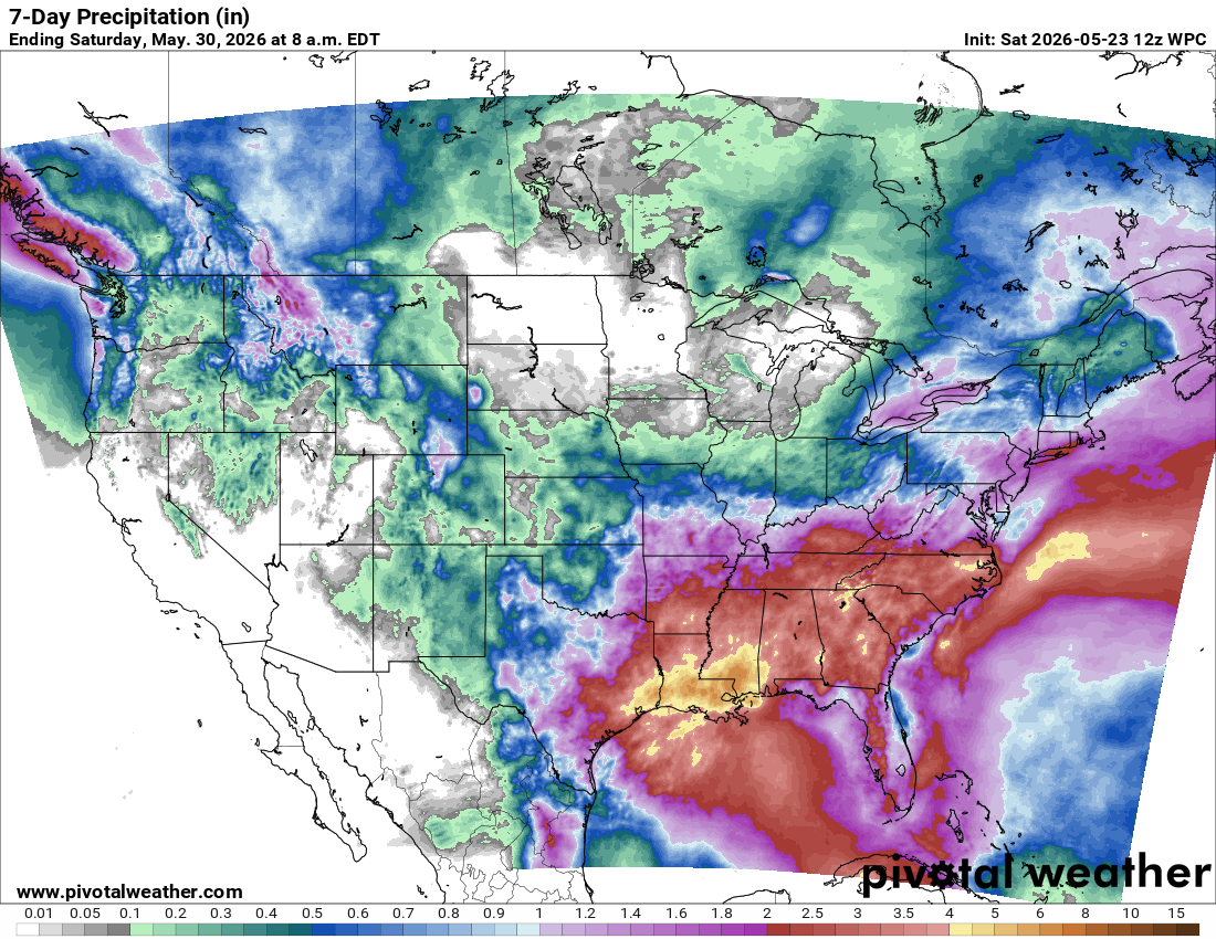
This will bring several inches of rain over the next week to much of the southeast quarter of the nation. While this area desperately needs the rainfall to help with ongoing severe drought conditions, there will also be situations like we saw in the Mobile area on Friday where focused and persistent heavy downpours will cause localized significant flash flooding.
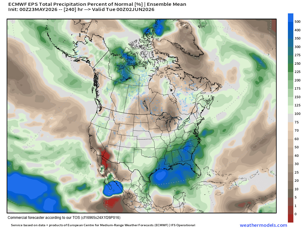
Omega block patterns tend to be rather prolonged and stable, and as a result this should mean an extended period of wetness for the Southeast with well above normal precipitation anticipated the next 10 days. This somewhat unusual weather pattern will actually favor above normal rainfall for much of the country, with the main exceptions being the upper Midwest (and into central Canada) where the upper level ridge will bring unusually warm and dry conditions. Parts of the Intermountain West and Southwest also look to be drier than normal for the next 10 days per the European ensemble forecast shown above.
Balanced Weather is made possible by the generous support of paid subscribers, who as thanks get access to live Balanced Weather chats and videos as well as the ability to post comments and ask questions on posts. To become a paid subscriber or a free subscriber (also very much appreciated and you will automatically receive new posts in your email), please click below.
I like the clever title and the Omega Block explainer! Thanks!! Do the colorful geometric symbols in the All Severe PPH map represent different types of recording stations or what?