
Summer flash flooding once again becoming a major story in 2026 as it did last year
Flash flood events in Ohio and the New York City metro highlight the dangers of increasing rainfall rates
The last couple of summers have been full of impactful flash flood events, and Monday saw a couple of more.
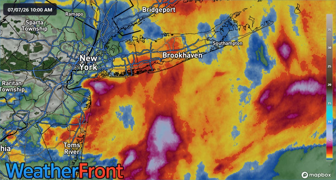
The first event I want to highlight was in the New York City metro area. While this 24-hour rainfall map shows that nearly all of the heaviest rain fell offshore, enough of it fell over land to cause serious problems in a classic example of how high rainfall rates can overwhelm infrastructure.
In this loop from the NSSL Multi-radar Multi-sensor System (MRMS) website, we can see how showers and thunderstorms with torrential instantaneous rainfall rates as high as 6” per hour trained for about 90 minutes during the late morning along the Jersey Shore.
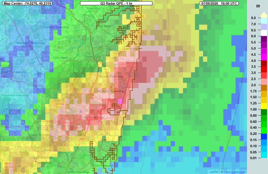
This resulted in a localized band of 3 to 4.5” of rain in just an hour from Long Branch down through Wall Township. A Citizen Weather Observing Program gage near Asbury Park reported 3.07” of rain in an hour between 11 am and Noon ET.
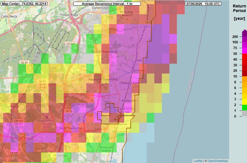
While radar based annual recurrence intervals tend to run a bit high, we can still see from the MRMS FLASH ARI product that these are extreme 1-hour rainfall totals in the neighborhood of 1% (1 in 100 year).
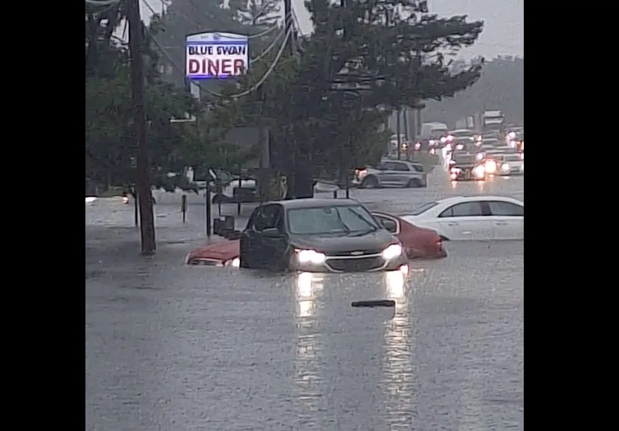
The result was major, rapid onset urban flash flooding with numerous flooded vehicles and water rescues reported. A large box store in Ocean Township suffered a partial roof collapse while shoppers were inside — while a couple of people were temporarily trapped, amazingly nobody was injured.
This event occurred in the NWS Philadelphia/Mt. Holly service area I want to note that they put out a proactive flash flood warning as heavy rain was ramping up in the area, and pretty quickly upgraded it to a “considerable” tagged warning for life threatening flash flooding that would have activated the Wireless Emergency Alert system. Interestingly, the “nextdoor” NWS New York City office never issued any “considerable” tagged flash flood warnings in spite of reports of submerged vehicles near Coney Island and in Suffolk County, in an interesting echo of how the office handled a (to be clear, much more serious) flash flood event back in May as I talked about here.
The other flash flood event I want to talk about occurred in the vicinity of western Lake Erie, where a cluster of slow moving thunderstorms meandered around in the early morning hours of Monday.
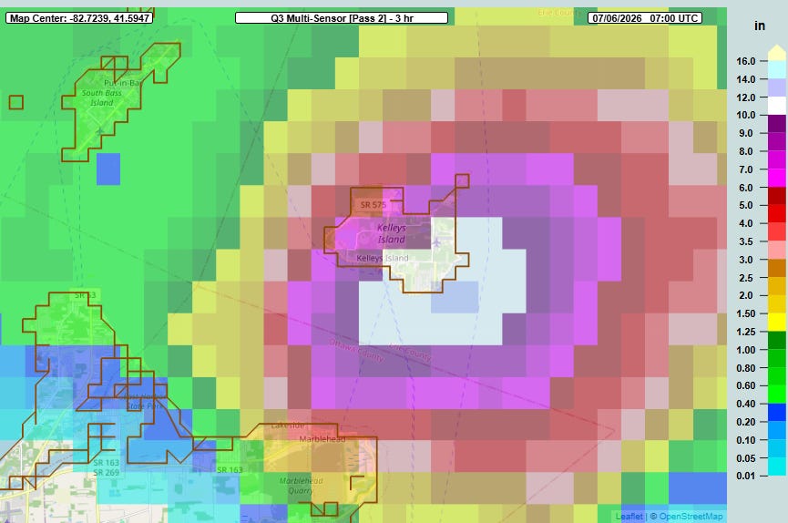
While as in the New York City area case, much of this heavy rain fell offshore, the rainfall maximum did impact Kelley’s Island, a vacation island offshore of Sandusky, OH. MRMS multi-sensor, gage corrected rainfall estimates show that an incredible 10-12” of rain fell in just 3 hours ending at 3 am ET.
My meteorological colleague Jeff Berardelli highlighted on Bluesky just how insane this rainfall was — essentially the 10-12” in 3 hours would be in the neighborhood of the Ohio all-time 24 hour rainfall record.
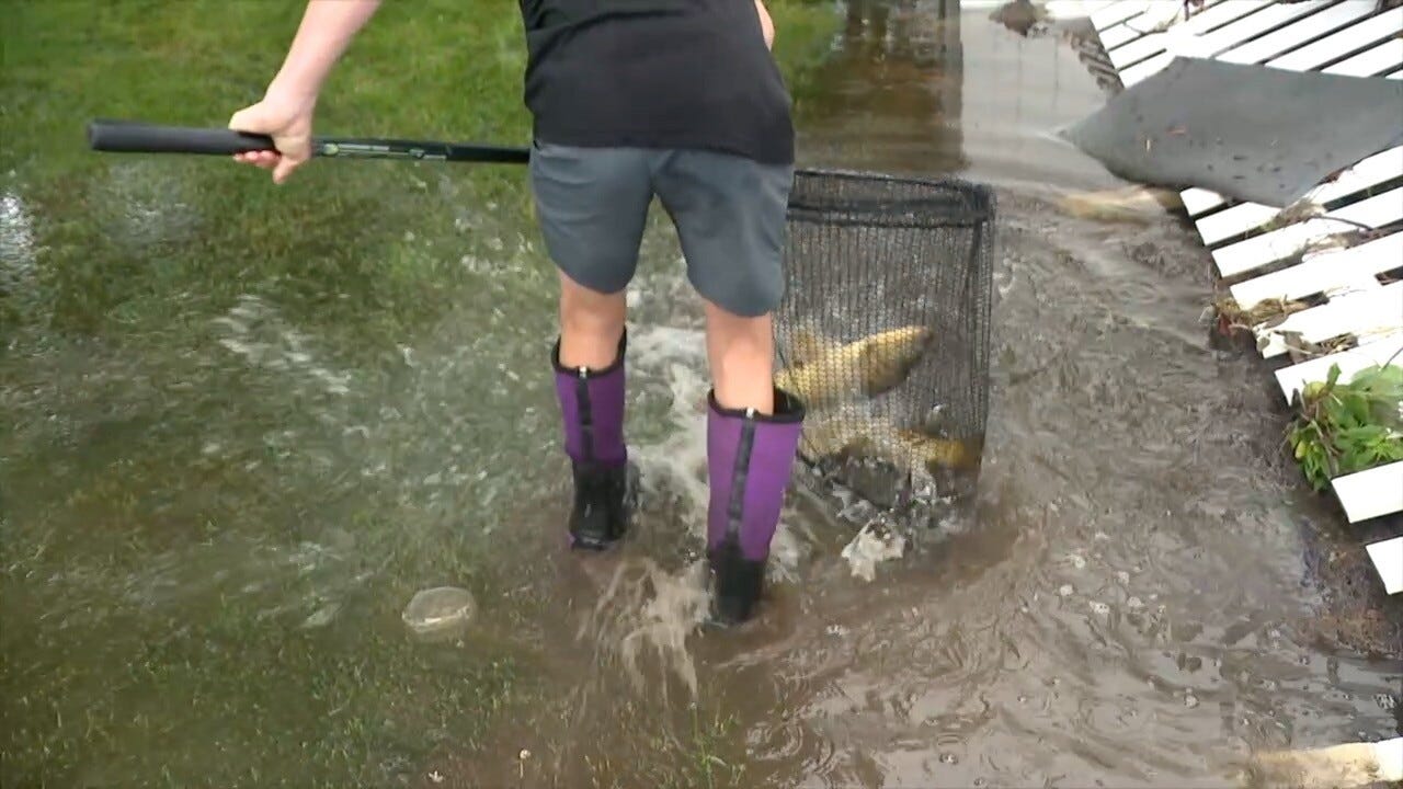
NWS Cleveland reported that several private weather stations on the island recorded between 12 and 14 inches of rain in 6 hours ending around 3:30 am — if and how those reports might be validated to confirm a new state rainfall record is unclear. Regardless, on the ground reports indicate that major flooding impacts resulted including propane tanks floating away and inundated basements.
While one cannot say that any one weather event was directly caused by climate change, the connection between global warming and increased atmospheric moisture and rainfall rates is one of the most clearly documented impacts of climate change. This is almost certainly resulting in rainfall events that are more frequently overwhelming human infrastructure literally built for a climate with less moisture. Given this, flash flooding is only going to become a growing problem for all of us — and this just reinforces my plea on the anniversary of the Texas Hill Country flood for us to make the improvement of monitoring and warning systems for flash flooding a national priority.
My weather update will come in a video again today, sometime later this afternoon.
Programming Reminder: Given the ongoing active weather, I am utilizing the Substack Chat feature to share periodic real-time updates. I also do occasional live videos to provide briefings and updates about the evolution of severe weather and flash flooding risks. As a reminder, these are benefits that paid subscribers receive for their support of Balanced Weather. Any videos I do will also be recorded and shared to all subscribers. I also provide updates on my BlueSky and Facebook feeds, and via occasional Substack Notes.
Balanced Weather is made possible by the generous support of paid subscribers, who as thanks get access to live Balanced Weather chats and videos as well as the ability to post comments and ask questions on posts. To become a paid subscriber or a free subscriber (also very much appreciated and you will automatically receive new posts in your email), please click below.