


Severe weather knocks out power to 400K across the Midwest
Erick becomes a major hurricane in the eastern Pacific and approaches the coast

Sorry for all the emails today, but there’s lots of weather going on and want to keep the Balanced Wx community up to date as I can. First, the severe weather has been quite impactful across the Midwest today, with right at 400,000 customers now without power due to the storms, most of them in Indiana and Ohio.

Much of the damage has been due to straight line winds - SPC has received over 300 reports of wind damage - associated with an intense squall line that developed late this morning over eastern Illinois and moved east through the day. One of the highest measured wind gusts recently occurred just west of Cleveland just before the time of the radar image above, with an 81 mph gust at the Lorain County Airport between Elyria and Amherst, OH.
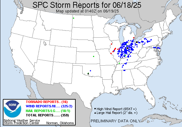
There were several tornadoes across central Illinois, primarily with supercell storms early in the event. Damage was reported in Jacksonville, IL from a tornado that produced a significant debris signature in data from the central Illinois NWS Doppler radar.

The line of severe storms continues to press east across Ohio, with severe thunderstorm and tornado warnings in effect. Severe thunderstorm watches are in effect from Lake Erie to middle Tennessee. The storms should weaken over the next few hours as they move east into more stable air.

Bands of storms should reintensify during the day Thursday as the system moves east, and a slight (level 2 of 5) risk of severe storms is in place from northern New England south to North Carolina.
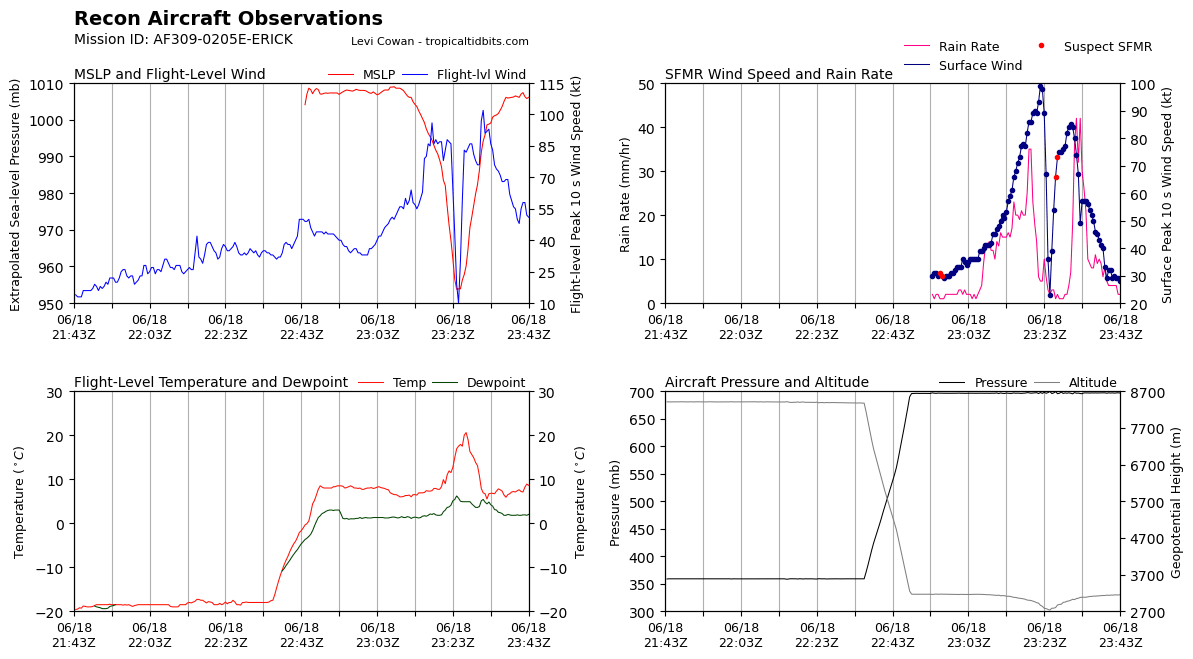
The other major news this evening is that Erick has strengthened into a major hurricane in eastern Pacific. A reconnaissance aircraft pass through the storm this evening found that the central pressure of the storm had dropped about 20 millibars since this morning, down to 953 mb, and found surface winds of 100 knots. The NHC official intensity has been increased to 120 mph, a category 3 hurricane.
GOES infrared satellite imagery this evening shows that the storm continues to intensify, with increasing cold topped thunderstorms forming a ring around an eye which is becoming warmer, all signs of intensification.
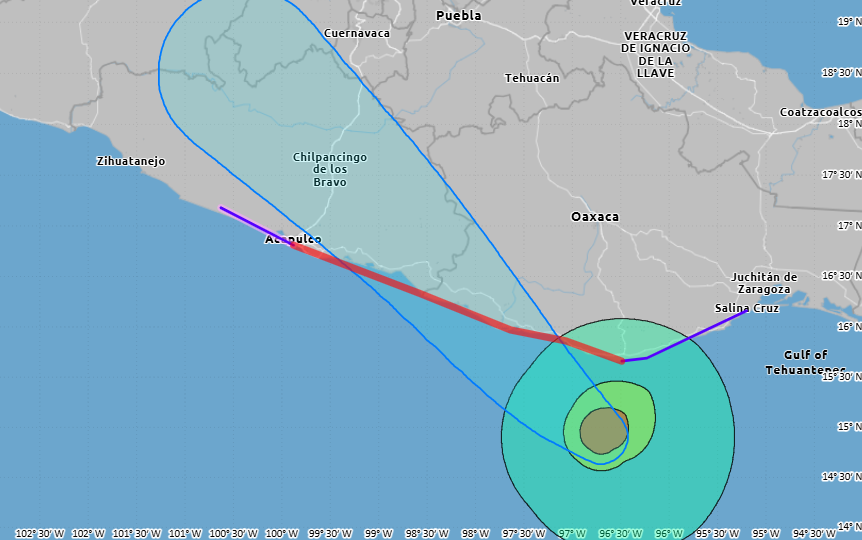
NHC is forecasting Erick to continue to intensify up through landfall, which is now expected to be a bit earlier - Thursday morning - and bit farther east than earlier forecasts, likely in the general vicinity of the border between the states of Oaxaca and Guerrero. Devastating wind damage is expected near where the core of the hurricane crosses the coast, with a significant storm surge near and to the east of the landfall point. Once it moves inland, the circulation will rapidly weaken over the mountainous terrain, but the heavy rainfall produced by Erick over that terrain will result in life-threatening flash flooding and mudslides.