


Quick update on Midwest severe weather and Erick
Live weather briefing at 3 pm CT
Hi everyone, I wanted to give a quick update on a few things happening this afternoon.
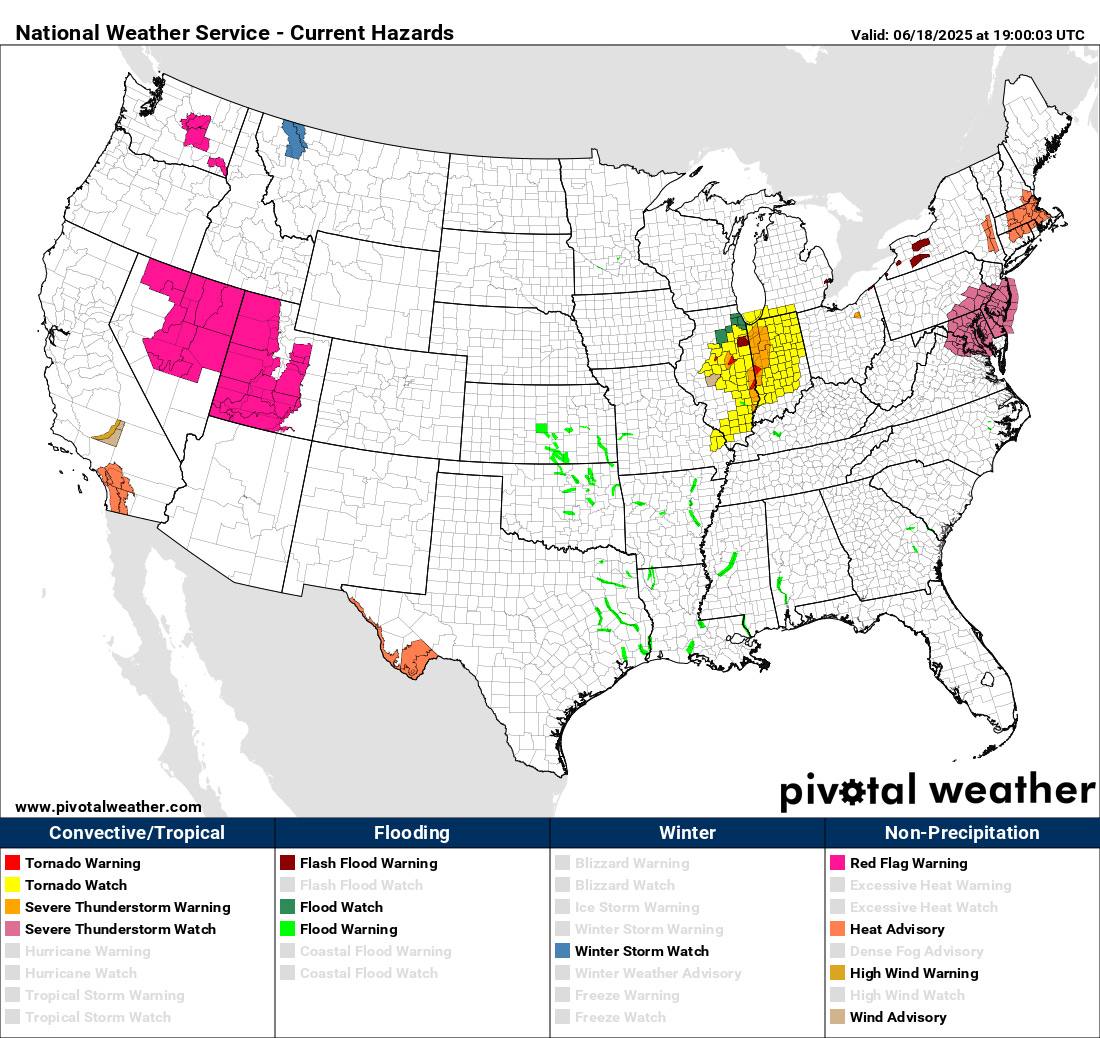
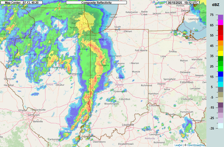
We now have tornado watches from southwest Lower Michigan to southeast Missouri as an impressive line of severe storms has developed ahead of the intensifying low pressure system, with some supercells actually behind the line across central Illinois. There have been several tornadoes in central Illinois this afternoon, including a damaging tornado with a radar debris signature near Jacksonville. The threat of tornadoes and numerous incidences of damaging winds will increase with this line as it moves east the next few hours.
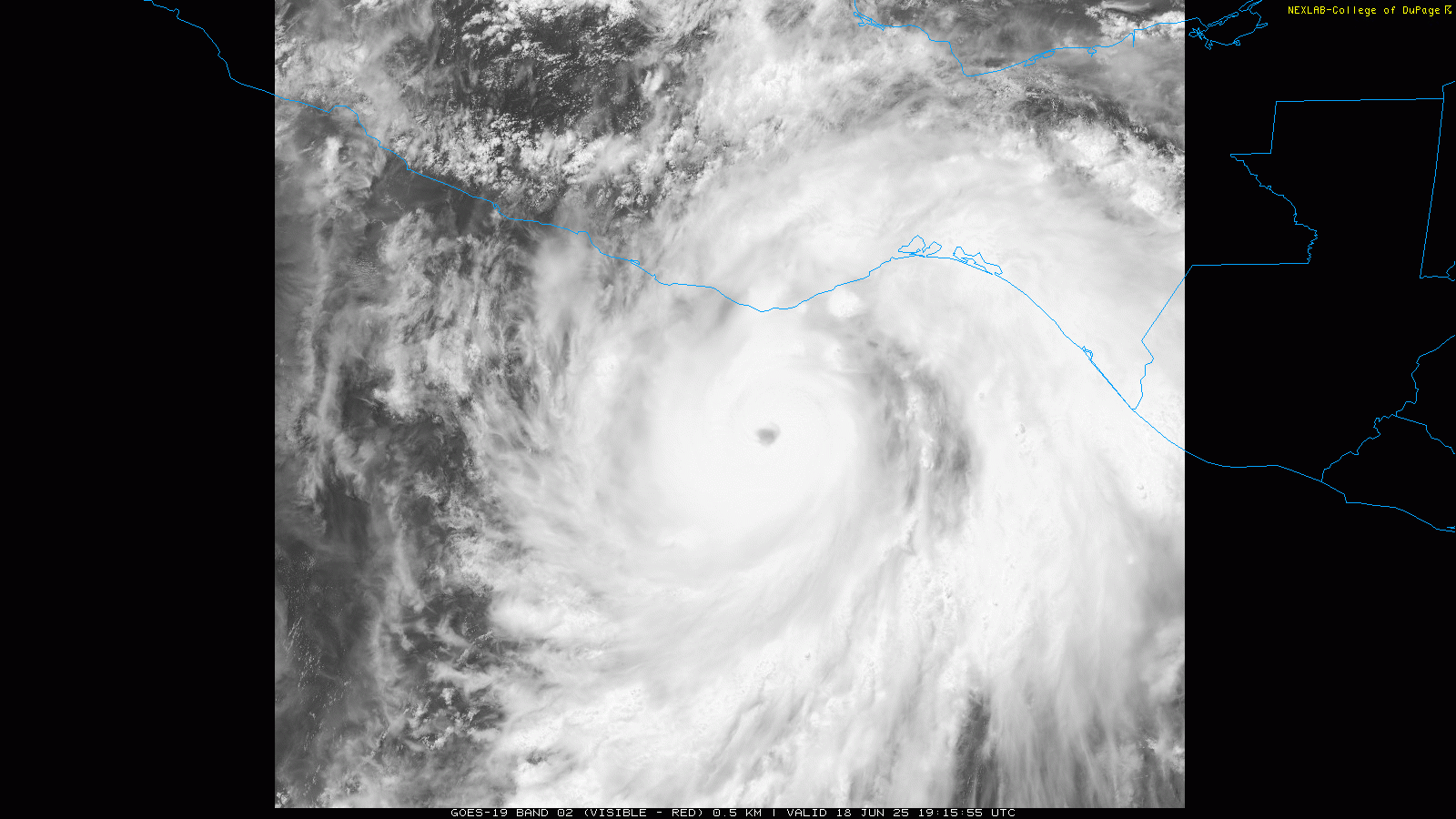
Satellite imagery and reconnaissance data show that Erick continues to intensify in the eastern Pacific, and is now a category 2 hurricane. The initial recon flight has left the storm, but it was intensifying fairly rapidly before the plan left with the central pressure of the storm dropping several millibars in between the two center penetrations by the plane. It continues to look increasingly impressive in satellite data this afternoon and will likely be a major hurricane soon.
I am planning to do a live paid subscriber Google Meet weather briefing at 3 pm to take a deeper dive into both the severe weather risk and Hurricane Erick, as well as the ongoing heat wave in the Southwest and coming heat wave in the East.