


More damaging flash flooding in WV
Active severe weather pattern this week
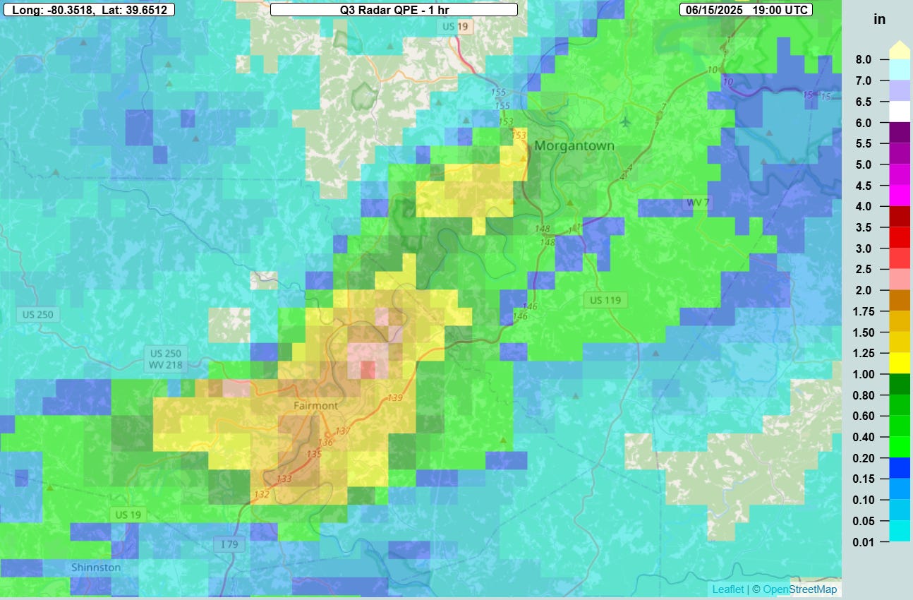
Sunday saw another case of localized very heavy rain falling in particularly vulnerable spot, this time in and above the West Virginia city of Fairmont. Multi-radar Multi-Sensor (MRMS) 1 hour rainfall estimates showed areas of 2.5-3” of rain in an hour as thunderstorms with torrential rain trained over the area.
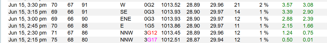
The radar rainfall estimates were supported by a Citizen Weather Observing Program observing site in Fairmont, which reported just over 3” of rain in a 75 minute period from 2:15 to 3:30 pm.
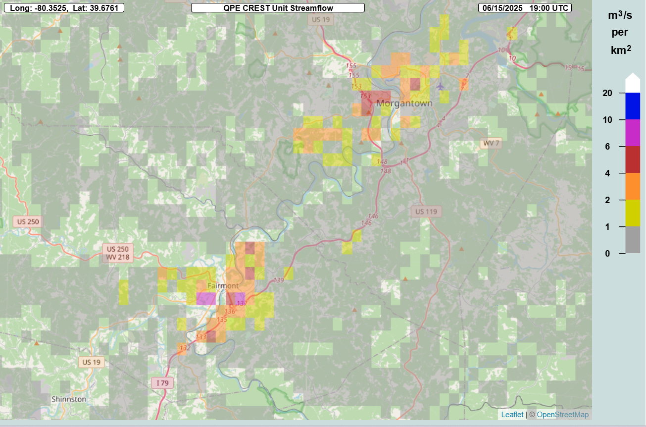
The MRMS FLASH unit streamflow hydrology product, which shows the amount of immediate runoff and inundation due to rainfall, showed the rapid runoff with values approaching 10, indicative of potentially significant flash flooding. These extreme rainfall rates in the steep Appalachian terrain are particularly dangerous, as the runoff feeds into valleys causing rapid inundation of low lying areas and extremely quick rises of streams and creeks out of their banks.
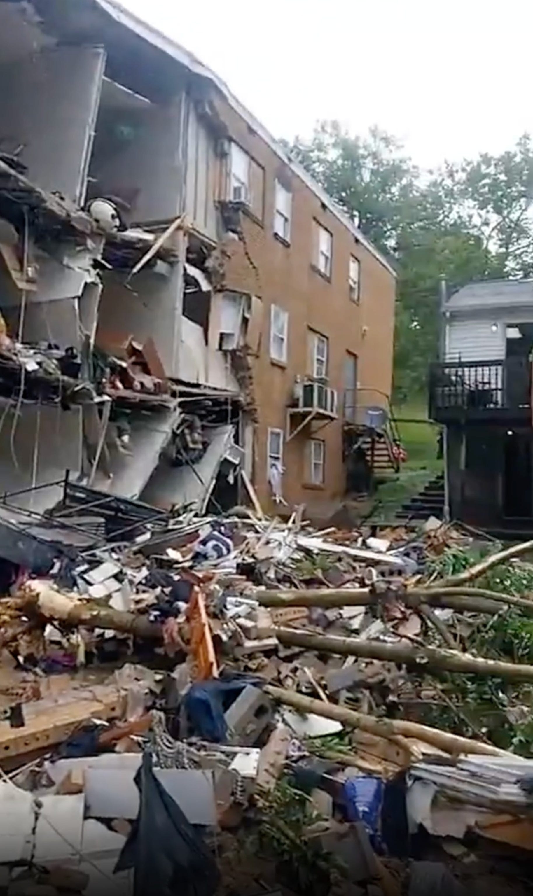
This was unfortunately the case in Fairmont as extensive flash flooding caused the partial collapse of an apartment building along with multiple inundated vehicles (picture above from ABC News story). The death toll in the flash flooding in West Virginia has risen to 6, with 2 people still missing.
My post on BlueSky last night about the Fairmont flooding led to a conversation with my colleague Ray Wolf, who is the retired science officer from the NWS office in Davenport, IA. He pointed out the importance that MRMS and FLASH - the systems from which I posted products above - have to the NWS flash flood warning program. Those systems were developed by the NOAA Office of Oceanic and Atmospheric Research (OAR) National Severe Storms Lab and transitioned to operations about a decade ago.
MRMS and FLASH (click on the links to learn more) remain the key tools for NWS forecasters to monitor rainfall rates and the rapid inundation that causes flash flooding. Research and development continues to not only improve the products, but researchers and NWS forecasters also have ongoing collaboration that enhances how the NWS uses the products to issue better warnings. As I wrote about in this post last week, under the FY26 President’s Budget OAR would be eliminated as a NOAA line office, ending innovative research-to-operations efforts like this.

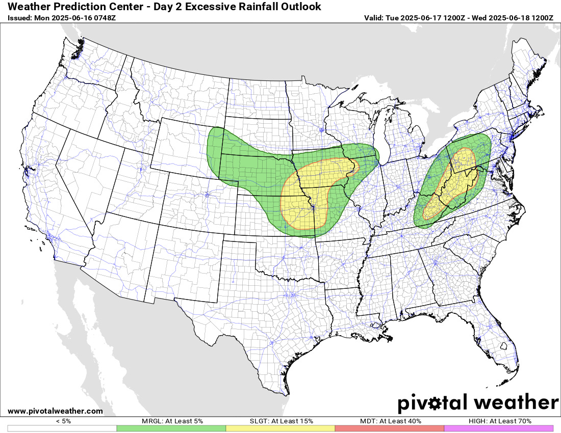
The next couple of days will continue to see a threat of locally heavy rainfall across the central Appalachians and Mid-Atlantic ahead of the remnants of the upper low that caused the flash flooding in Texas last week. If the heaviest rain falls in a particularly vulnerable area like happened over the weekend in Wheeling and Fairmont, significant impacts could again occur.

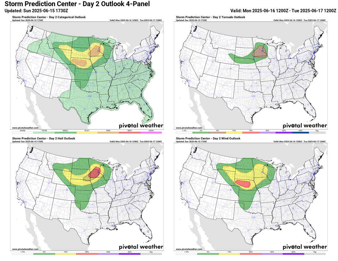
The next couple of days also look quite active on the severe weather front, with enhanced (level 3 of 5) risks in place both days. Today, as an upper level system moves into the upper Midwest, severe thunderstorms capable of very large hail (2+”), significant wind gusts (75+ mph) and a few tornadoes are anticipated. On Tuesday, severe storms are anticipated along a slow moving cold front with additional risks of very large hail, significant wind gusts and a few tornadoes.

The upper level weather disturbance that will produce the severe weather today was responsible for a very active day of severe weather on Sunday in the northern Plains, with nearly 200 reports of severe weather in that region, including a number of significant wind gusts and very large hail reports.
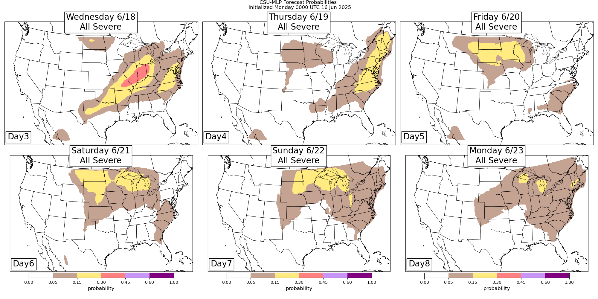
This active severe weather pattern looks to last much of the upcoming week as disturbances will move across the northern and eastern United States in a band of stronger mid and upper level winds on the north side of building areas of mid and upper level high pressure areas across the Southern United States. Given plenty of muggy and unstable air to feed storms, numerous waves of severe storms are anticipated. While the exact days and locations for the highest risks will likely evolve a bit, the Colorado State University-Machine Learning Probabilities system forecasts above show the general idea as far as the areas most under severe weather risk for the later part of the week.
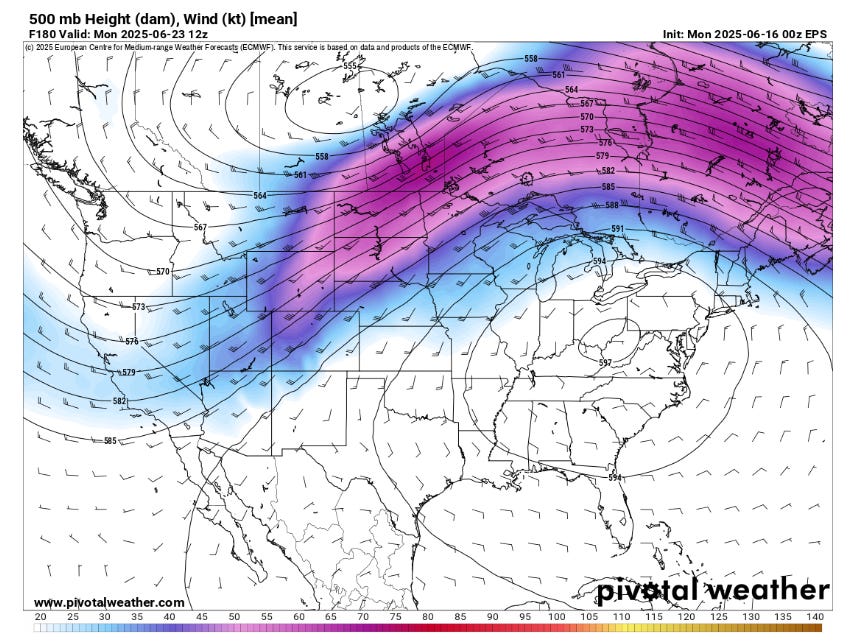
As we get into the weekend and first part of next week, it looks as if a more amplified mid and upper level weather pattern will evolve with a trough developing along the west coast and an unusually strong and large area of high pressure over the eastern United States. This will likely bring the first widespread and prolonged heat wave to the eastern half of the country for next week.
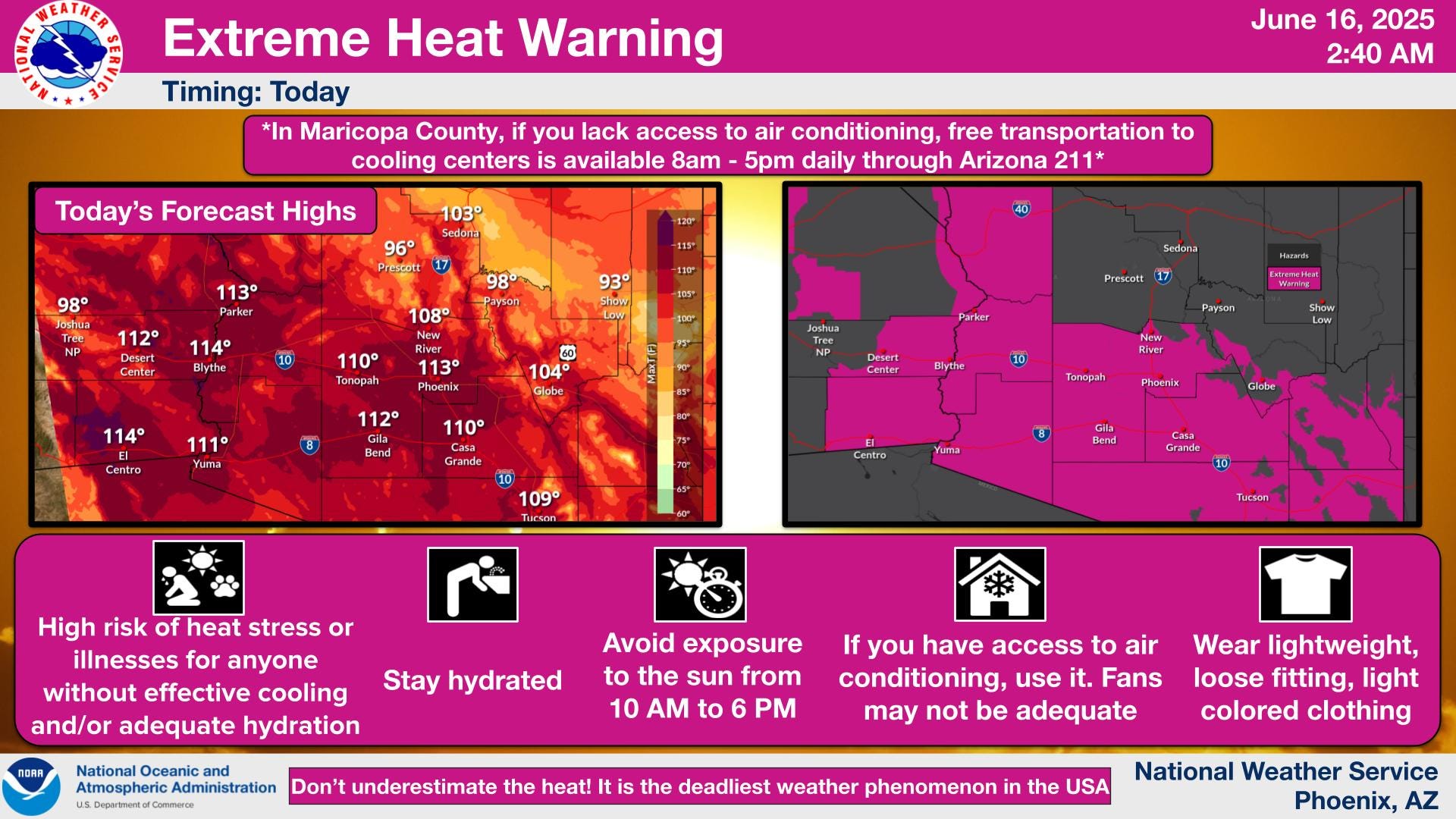
As far as heat this week, the heat that started over the weekend over the Southwest (114F high at Phoenix Sunday, just one degree shy of a record) will continue today, with extreme heat warnings in effect. Fire danger will also be a concern for much of the Southwest the next couple of days. The heat will back off a little for a day or two, but then rebuild and expand northeast for the middle and later part of the work week.
Record high temperatures are anticipated across parts of the central United States by Friday.