
Major winter storm in progress for the Carolinas, while Arctic air continues to surge toward Florida
150,000 customers still without power from last weekend's ice storm as temperatures plunge into the teens
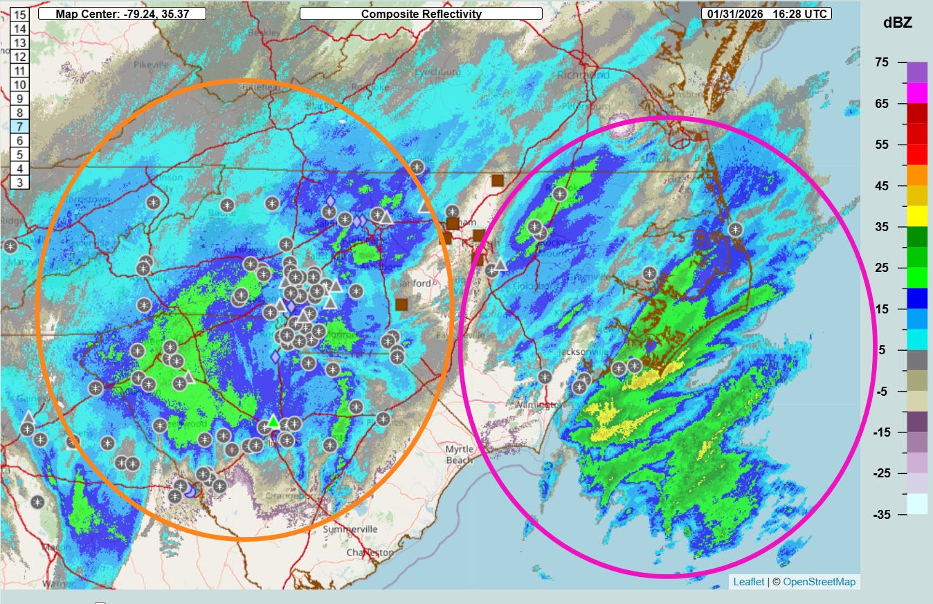
The major winter storm in the Southeast is in full swing here at midday Saturday. In the Multi-radar Multi-sensor System mosaic radar from the National Severe Storms Lab above (overlaid with reports from the mPING crowdsourcing system), you can see that there are two distinct areas of precipitation. To the west (orange circle) is an area of moderate to heavy snow that is primarily associated with the strong middle and upper level atmospheric disturbance that is driving this winter storm and Arctic outbreak. Farther east (purple circle), snow (and mixed precipitation offshore) is developing as the offshore surface low pressure begins to develop. Both of these areas of precipitation will continue to expand and intensify over the next few hours.

You can see this bimodal nature of the precipitation across North Carolina in the snowfall forecast from the morning High Resolution Rapid Refresh (HRRR) model, with a minimum in central North Carolina. While the minimum may not be as dramatic as shown here, given the recent observations and that this precipitation evolution is being seen in multiple high resolution models, it does seem clear there will be maxes in snowfall over the western North Carolina and closer to the coast, and a minimum in between. Farther south across South Carolina, the two areas will merge into one larger area of heavy snow for the northern half of the state. Within the heavy snow areas, banding of the snowfall will lead to localized maxima within those areas.
Another trend that we have been seeing in the model guidance as the storm has gotten closer and we have more high resolution models that can better handle the small scale atmospheric processes involved in this complex evolution has been a trend for the precipitation to be shifted a bit farther south than earlier model guidance. This means that most of the heavier snow looks to be shifted south of Virginia except some of the southwest mountains and perhaps extreme southeast Virginia near Virginia Beach. It also means that there will likely not be a shift in the track close enough to the coast to bring much more than some light snow to southeast New England.
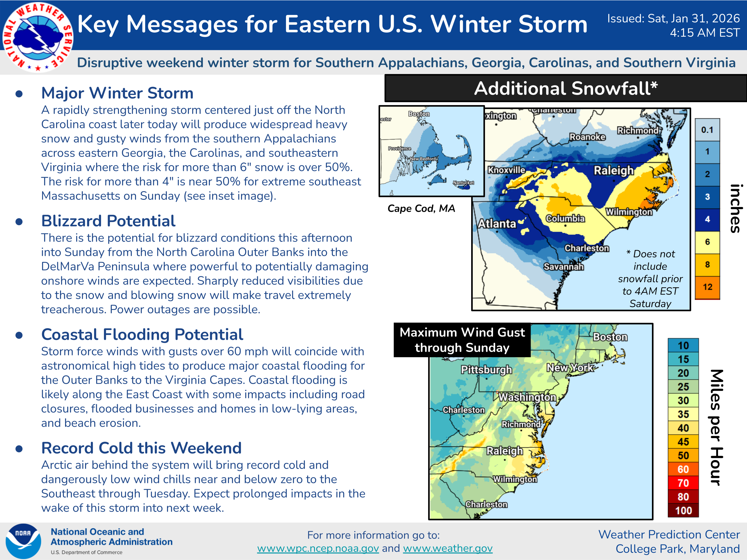
This Key Messages graphic from the NWS Weather Prediction Center does a great job of summarizing these trends, as well as the potential serious anticipated impacts from high winds and coastal blizzard conditions later today into tonight.
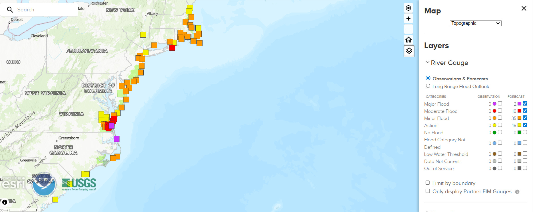
Even while moving farther offshore, the increasingly large and intense low pressure area will bring minor to localized moderate coastal flooding all along the Mid-Atlantic and Northeast coast, with widespread moderate to major coastal flooding focused in the Virginia Capes and North Carolina Outer Banks.
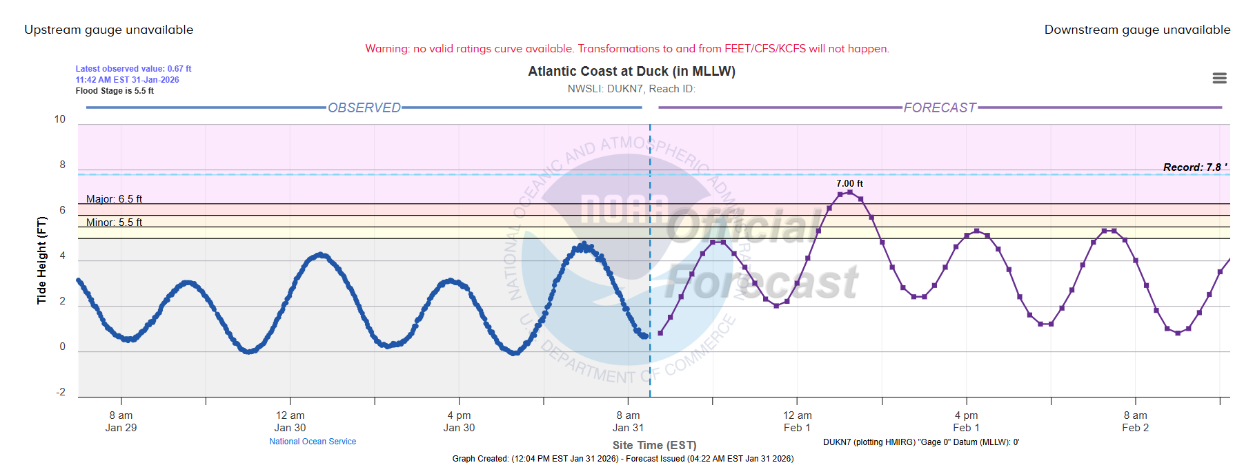
Current forecasts show that the high tide cycle overnight tonight will be the most impactful period in this region, with the forecast at Duck, NC in the northern Outer Banks showing the greatest flooding potential. If the forecast maximum tidal level of 7’ verifies, it would be the sixth highest on record for this location (back to the 1990s).
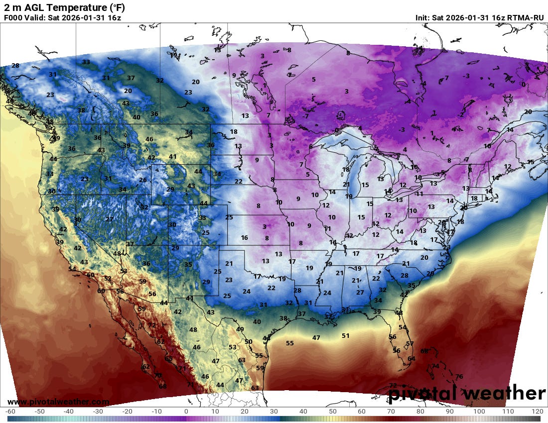
The other big story this weekend is of course the bitterly cold Arctic air associated with this weather system. Temperatures in the teens have now pushed as far south as the Mid-South and Mid-Atlantic, with single digit and subzero temperatures farther north.
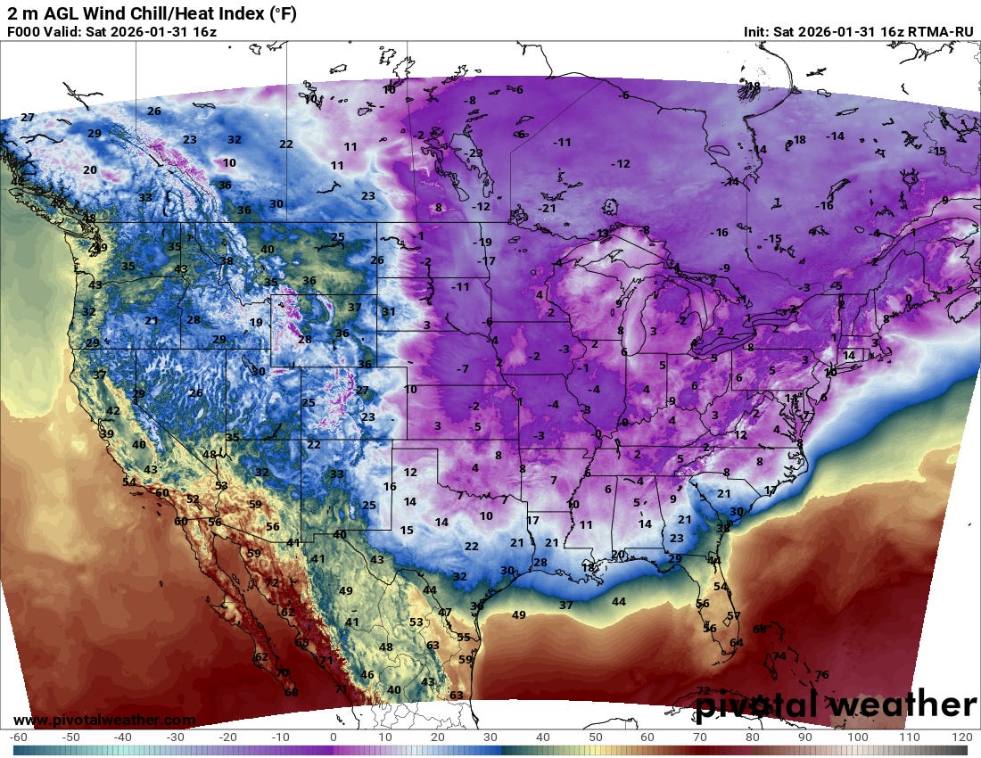
Gusty north to northwest winds are resulting in wind chill readings about 10 to 20 degrees colder than the ambient temperature, with single digit readings as far south as central Alabama, northern Georgia and North Carolina.
As the low pressure system off the Carolinas rapidly intensifies tonight into Sunday, it will drive the cold air deep into the Southeast.

This includes Florida where a hard freeze is forecast well south into the Peninsula.
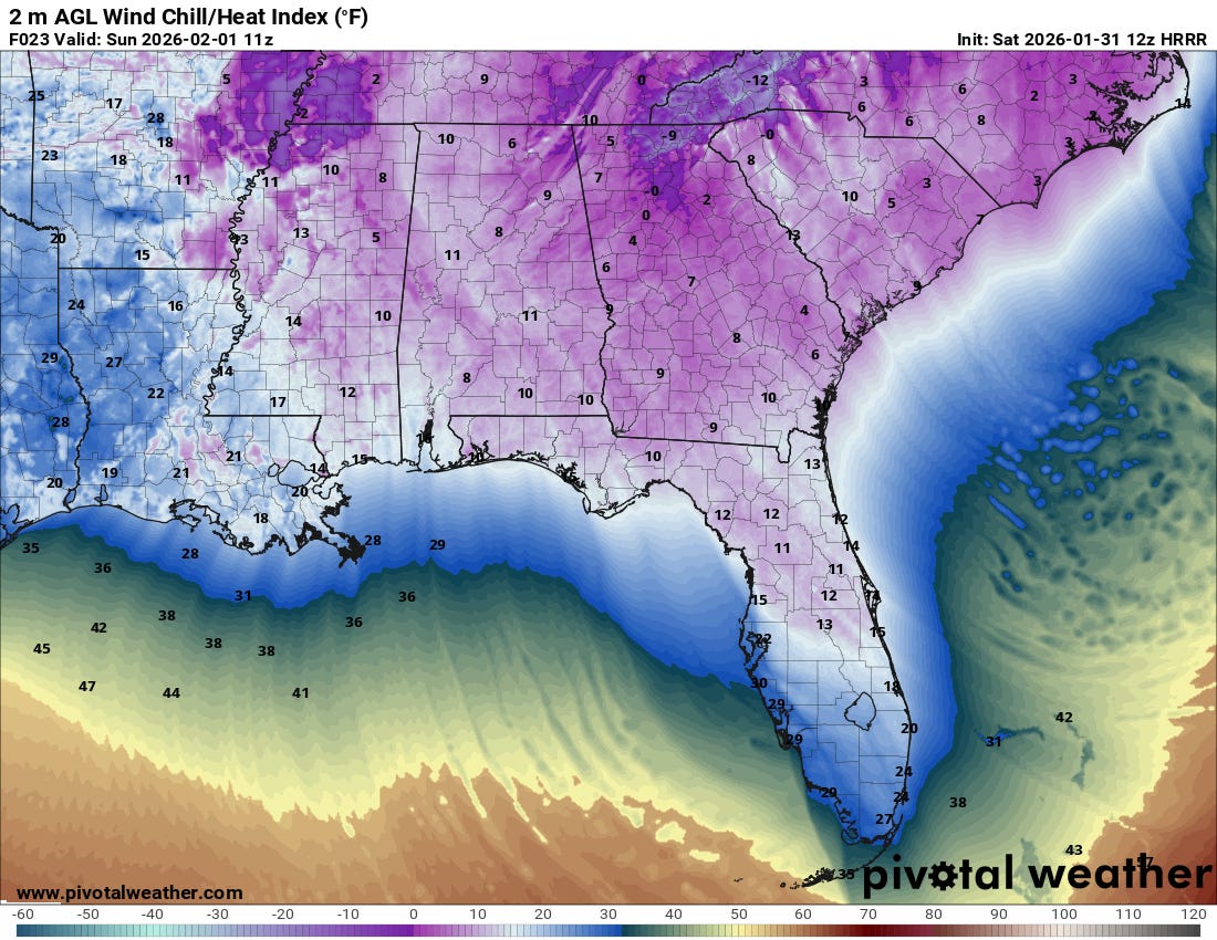
The combination of cold air and strong winds behind the developing low pressure area will drive wind chill readings down into the single digits and lower teens as far south as the Interstate 4 corridor in Florida. This magnitude of cold air is highly unusual in Florida, and will pose a significant threat to humans (especially those without adequate shelter), plants and animals, and infrastructure not built for this level of cold.

Another area of major concern continues to be the areas still recovering from last weekend’s major ice storm, with more than 150,000 customers still without power. Temperatures are well below freezing in this area and with overnight low temperatures anticipated to be in the teens tonight with wind chill readings as low as zero, significant risks of hypothermia exist for those without power and heat. Additional power outages could occur in this region this afternoon as wind gusts up to 35 mph impact damaged trees and power infrastructure, and of course power outages will be possible the closer one gets to the developing low pressure center where even stronger winds are anticipated. With unusually cold air expected to persist into early next week, the threats from these power outages will remain significant.

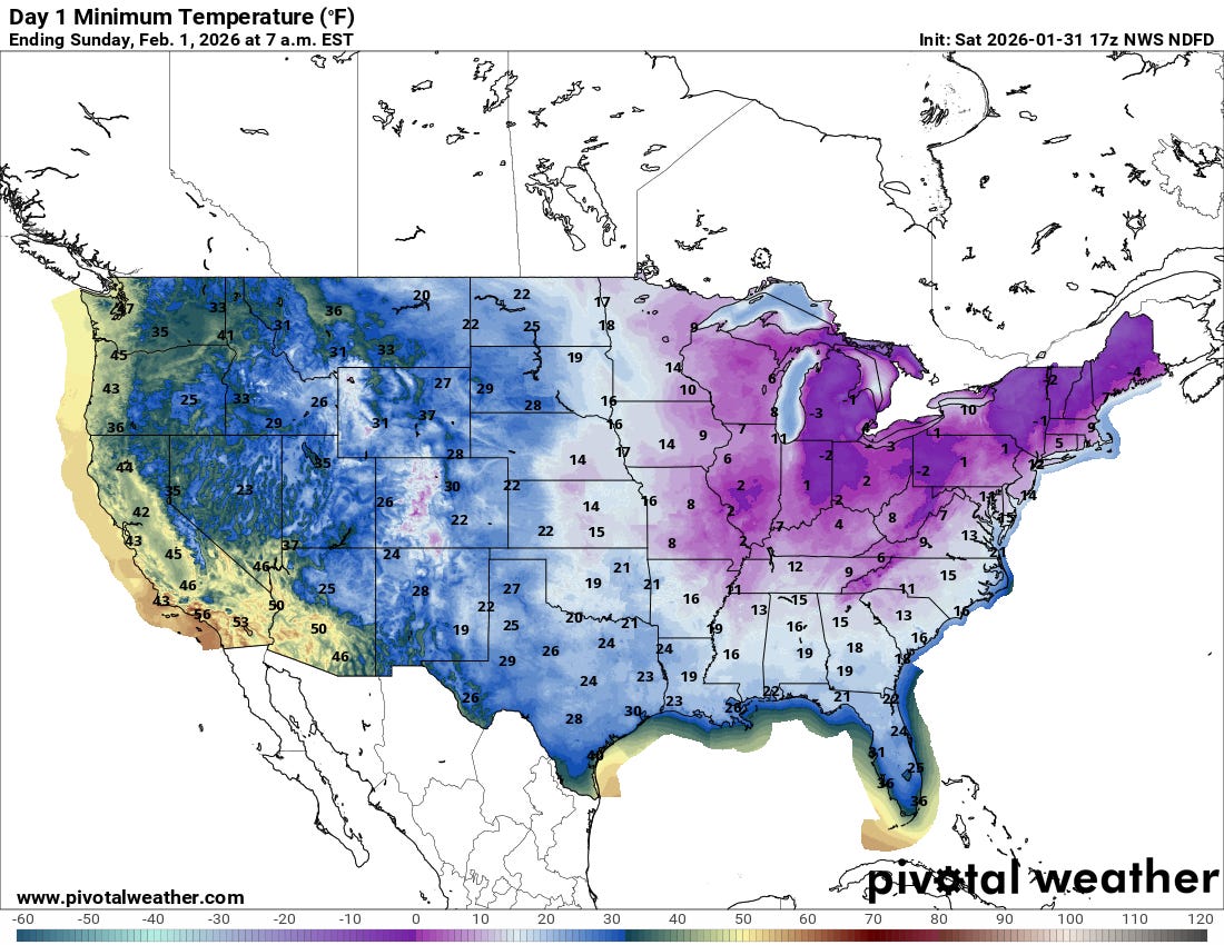
Some record cold temperatures were set Friday into Saturday morning across parts of the Northeast and Great Lakes, and numerous record cold temperatures are expected Sunday (forecast record lows above) across the Southeast including Florida.
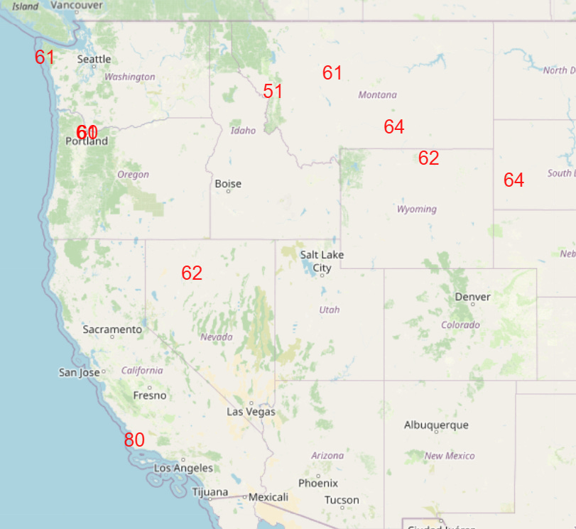
Meanwhile, I have not talked much about the weather out West lately as it has been relatively quiet in most areas under the influence of a large high pressure system aloft, with only the Pacific Northwest seeing some waves of precipitation at times. This pattern has also yielded some periodic record warm temperatures, including record highs yesterday in the LA Basin. This pattern will generally continue into next week, and by Thursday a number of record warm temperatures are possible (forecast record highs shown above).
Balanced Weather is made possible by the generous support of paid subscribers, who as thanks get access to live Balanced Weather chats and videos as well as the ability to post comments and ask questions on posts. To become a paid subscriber or a free subscriber (also very much appreciated and you will automatically receive new posts in your email), please click below.
I am in the gap between the two systems. Probable cause could be hot air outflow from the numerous local institutions of higher learning?