


Heat in Arizona...heat in Alaska
Plenty of thunderstorms around this weekend
Doing the Saturday newsletter early as I am going to be busy during the morning hours.

As we have been discussing for a few days, the weather pattern this weekend will become dominated by large areas of mid and upper level high pressure developing over the Southwest and over Florida. Plenty of moisture over the eastern two-thirds of the country will support scattered to numerous showers and thunderstorms over most areas.
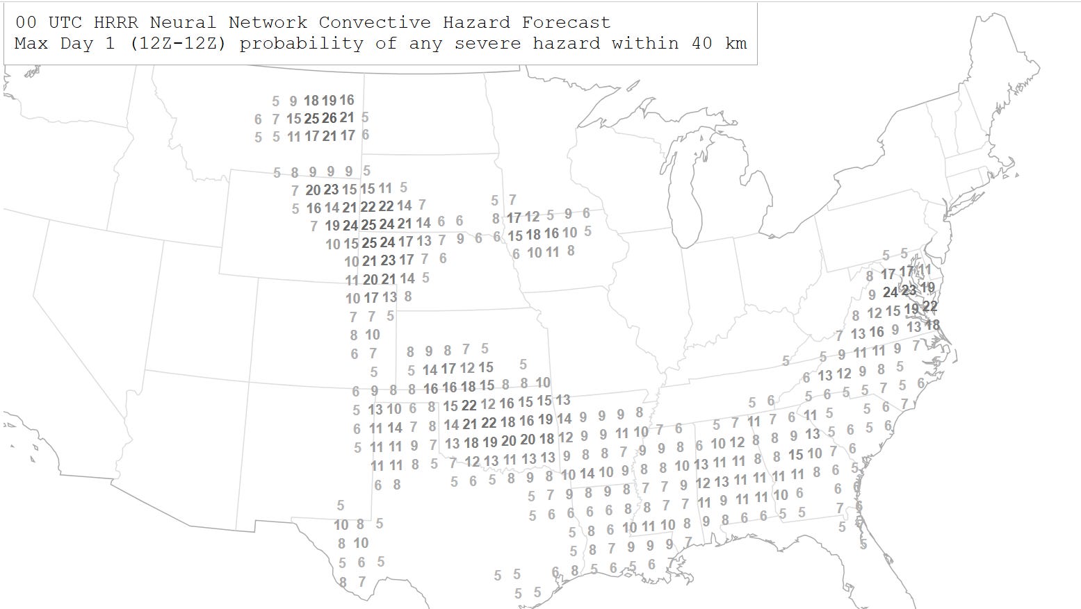
One trend I have noted for Saturday in the latest high resolution models has been a trend for more intense activity across parts of the Southern Plains in the northwest mid and upper level flow north of the building high over the Southwest. The latest NCAR neural net severe weather probabilities shown suggest probabilities indicative of a bit higher risk of severe weather than earlier expected, with some risk of large hail and damaging downburst winds.
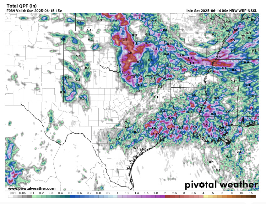
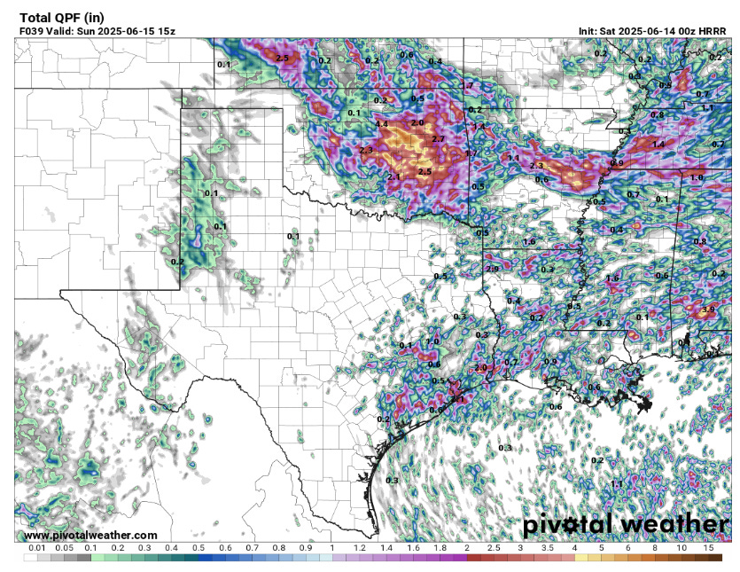
It also looks like there could be a few repeat rounds of thunderstorms in an unusually moist environment, which could result in several inches of rainfall. Given recent wet conditions over the last several weeks, this could result in flash flooding concerns. Locally heavy rainfall will also be a potential issue over much of the rest of the east. In particular, heavy rain and flash flooding looks to be a risk overnight Friday night in the Interstate 40 corridor of Arkansas and western Tennessee, with another more focused flash flooding risk on Saturday in the Mid-Atlantic where conditions have also been wet.
Severe weather will continue to be a risk in the northern Plains as well on Saturday. As a rather unstable airmass develops with decent mid and upper level wind shear, scattered supercell storms producing very large hail, damaging winds and possibly a few tornadoes are expected.
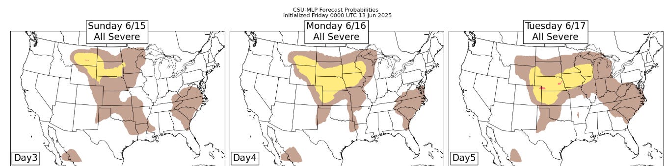
Heading into early next week, severe weather will continue to be a risk from the northern Intermountain region east across the upper Midwest as disturbances move east through stronger mid and upper level winds on the north side of the Southwest upper level high pressure center.

Under the high pressure center itself, heat will build through the weekend into Monday, with 110+F readings becoming widespread in the desert regions. Extreme heat warnings are in effect through Monday across the region.
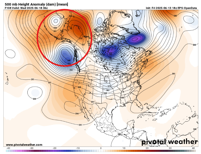
Speaking of heat, I want to highlight an unusual weather pattern that is forecast to develop over Alaska over the next several days. A blocked upper level pattern is forecast by the models, with a large unusually strong mid and upper level high pressure center expected to become established across most of Alaska for several days.
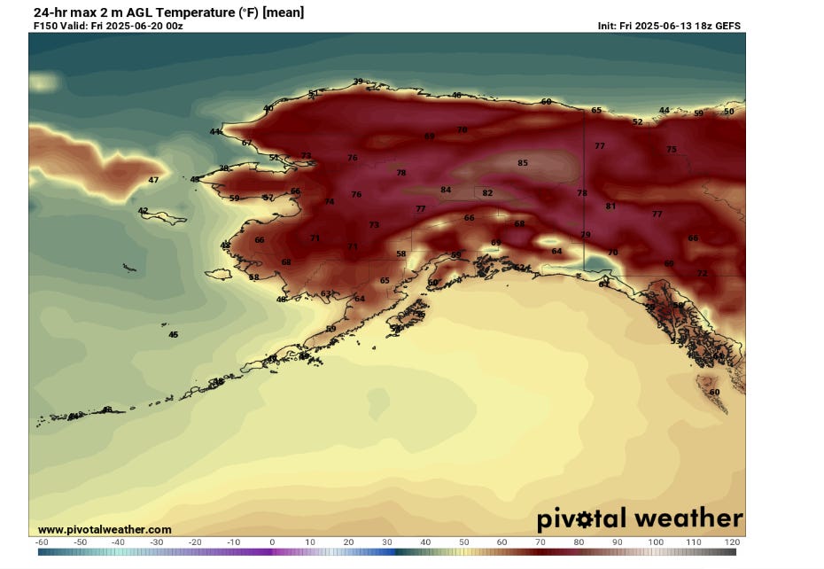
After what has been a rather unusually cool late spring for much of the state, things will flip to unusually warm - and even hot - weather for the inland areas of northern and central Alaska. Highs in the mid to upper 80s will be common in a number of areas, including the Fairbanks area.
The NWS office in Fairbanks issued their first ever heat advisory today. While the temperatures forecast this week will be near records on some days, the reason for the first heat advisory ever is that this is the first year the issuance of heat advisories has been an option for NWS offices in Alaska. Given that air conditioning is very uncommon in Alaska and people and animals are acclimated to cooler temperatures, the temperature criteria for heat advisories is lower in Alaska that in the continental US.
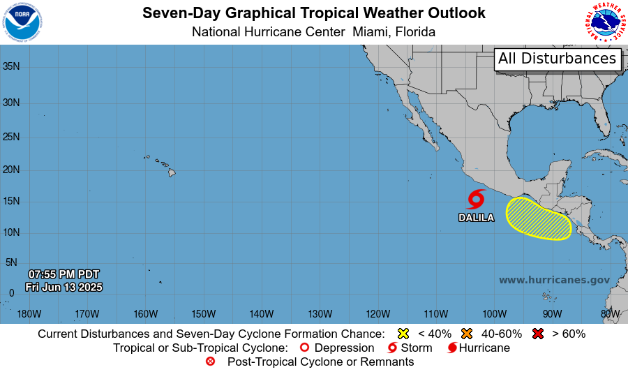
Looking at the tropics, tropical storm Dalila has developed off the southwest coast of Mexico, and is bringing heavy rains and gusty winds to coastal areas. Dalila should intensify a bit more as it moves northwest, before weakening and turning west offshore. With the overall continued favorable environment in the vicinity of central America, the models continue to suggest another system developing southwest of where Dalila currently is. While most models suggest it also staying somewhat offshore, depending on if, where and how it develops, there could be impacts to coastal Costa Rica, Guatemala and southwest Mexico.
The most recent models have hinted at slightly higher probabilities that the next system in this pattern could develop in about 6 to 10 days on the Atlantic side, in the northwest Caribbean or southern Gulf. While there is a bit more model support, right now this is still a fairly low probability - just something to keep an eye on.
I went to Alaska July 1 in 2018. The temperatures exceeded the safety limit to land commercial airplanes on Gustavus. My flights were canceled because of heat. I am returning for the first time since then leaving Wednesday. I’m flying to Gustavus again. 😮