


Erin slogging through a reorganizing phase
Much of the country will experience periods of significant heat over the next week
As we talked about yesterday afternoon, after its incredible rapid intensification episode, Erin went immediately into a reorganizing eyewall replacement cycle (ERC). Every ERC is unique, some can be relatively quick and happen in as little as 12 hours, and others can take a couple of days - and the ERC is a storm scale process that we still have limited ability to forecast.
For this ERC in Erin, it looks to be a gradual process, as to this point the outer eyewall has not fully taken over yet and Erin has weakened quite a bit as the ERC has slowly proceeded. The minimum central pressure has come up dramatically from its lowest point of 915 mb yesterday afternoon to 946 mb this morning. NHC is estimating the maximum sustained winds at 125 mph, and to be honest that may be a bit generous as there has not really been much wind data from the reconnaissance aircraft in Erin lately supporting even a major hurricane. Regardless, Erin should continue to be in an overall favorable environment for strengthening the next 48 to 72 hours, and once this ERC is finally complete it is expected to regain category 4 intensity. Erin is also growing in size substantially through this ERC process, with tropical storm force winds now extending 180 nmi northeast of center compared to 120 nmi 24 hours ago.
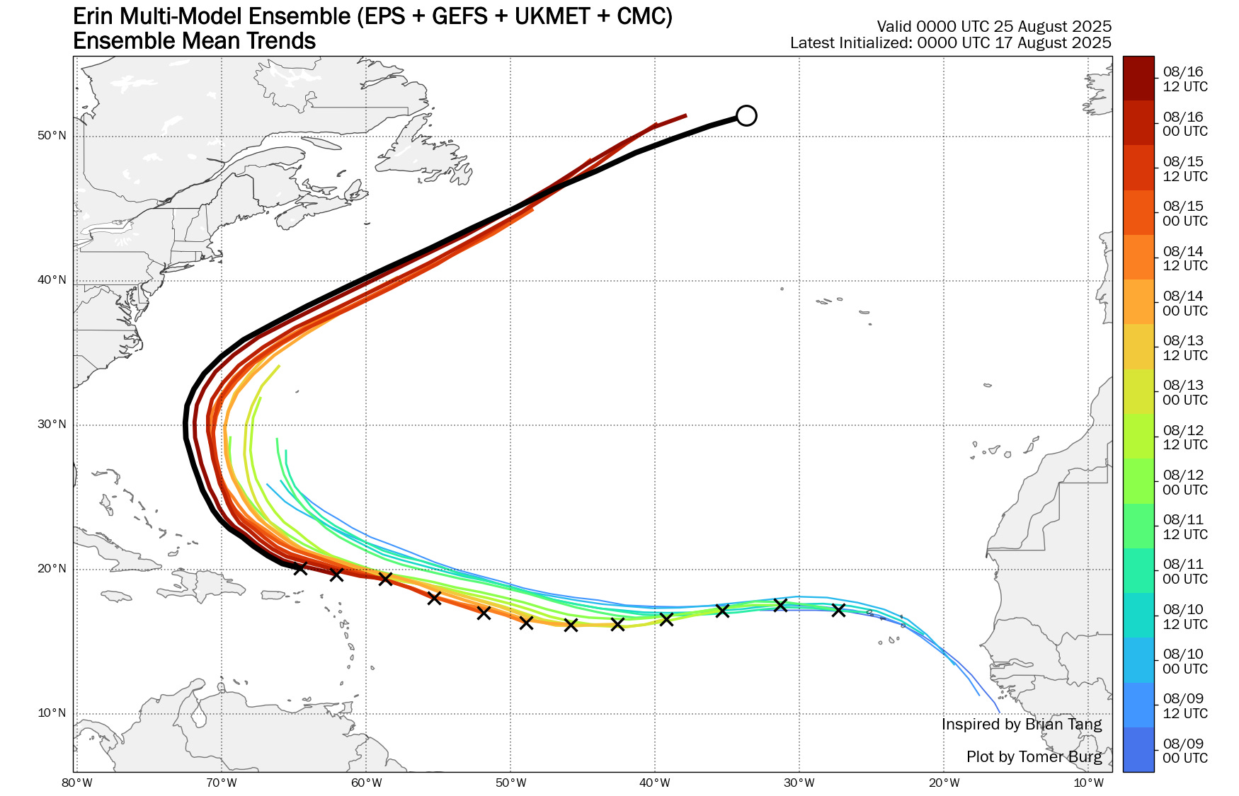
As far as track, Erin has continued to move along the southwest side of the model guidance, which has also continued to gradually shift west with time (black line in the graphic above is the most recent model “superensemble” track.) It now looks like Erin will pass close enough to the Turks and Caicos islands to give them some tropical storm force winds and heavy squalls, and a tropical storm warning is in effect there. Tropical storm watches are in effect for the rest of the eastern Bahamas.

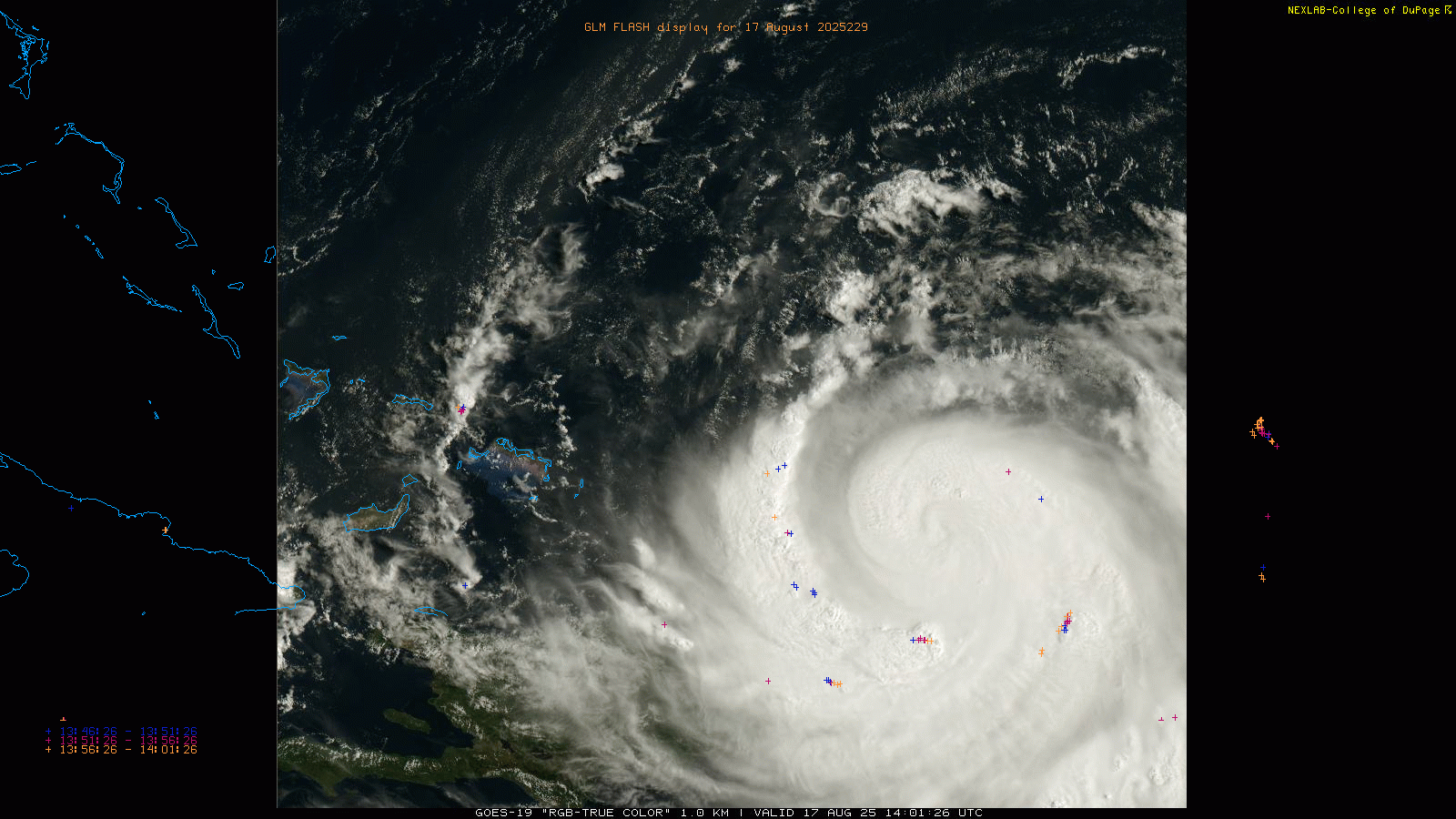
As expected, the southern rainbands of Erin have been providing some heavy squalls to Puerto Rico and Virgin Islands, with tropical storm force wind gusts and heavy rainfall. Rainfall has been particularly heavy in the British Virgin Islands where MRMS shows rainfall totals up to 10”.
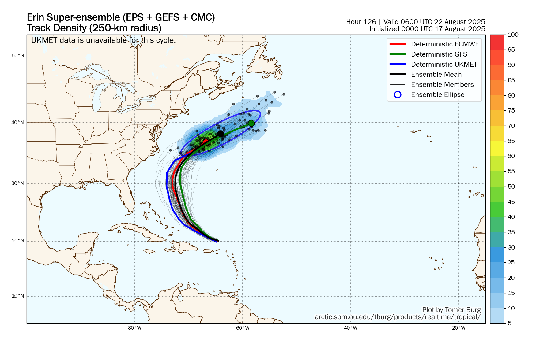
In the longer term, the models are in quite good agreement on a kind of perfect track that pretty much “splits the uprights” between the North Carolina Outer Banks and Bermuda.
![[Key Messages]](https://substackcdn.com/image/fetch/$s_!Dwx5!,f_auto,q_auto:good,fl_progressive:steep/https%3A%2F%2Fsubstack-post-media.s3.amazonaws.com%2Fpublic%2Fimages%2F9f3388d1-4741-4f81-8c76-923f409f4687_897x736.png "[Key Messages]")
While that would minimize land impacts, the East Coast will certainly have significant surf and rip current issues, and Bermuda will be on the “dirty” east side of the hurricane meaning the farther east the track shifts, the more wind and rain impacts they will have. Obviously there is still enough potential forecast error that both the Outer Banks and Bermuda should be monitoring Erin closely.
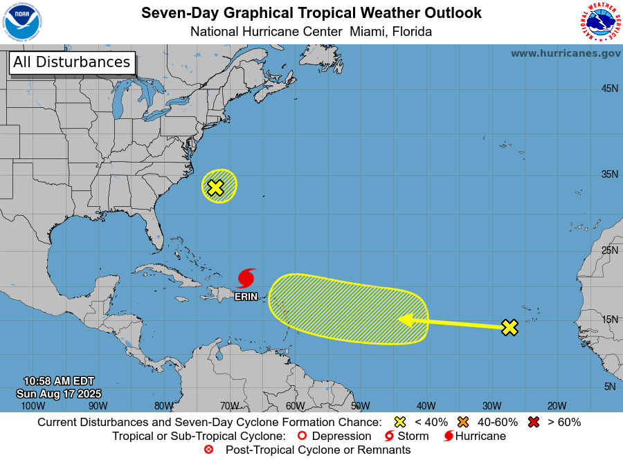
Outside of Erin, the main focus in the tropics is on the next tropical wave which is currently near the Cabo Verde Islands. Conditions ahead of this wave look rather favorable and the models have a pretty strong signal for development. As is not unusual at this time period, the models have differing ideas on the long term future of this system, as the global physical models tend to have more of a southern track that could be a risk for the Caribbean or Bahamas, while the AI models like the Google Deepmind and ECWMF AI show a rapid recurve into the north Atlantic. It probably mainly hinges on how quickly an organized tropical cyclone develops: a more rapidly developing system will be more likely to turn north into the weakness in the subtropical high pressure ridge that Erin will leave behind, while a slower developing system will be able to stay farther south. Regardless, we obviously are in the very early stages with this system and have a lot of time to monitor.

Turning stateside, the MRMS 48 hour rainfall map shows that the Pacific Northwest has received widespread welcome rainfall, while thunderstorms have been producing locally heavy rainfall over the upper Midwest and western Great Lakes regions.

Additional thunderstorms with intense rainfall rates are expected across the upper Midwest today as a low pressure system moves across the region. A slight (level 2 of 4) risk of flash flooding is in place in the red shown above.
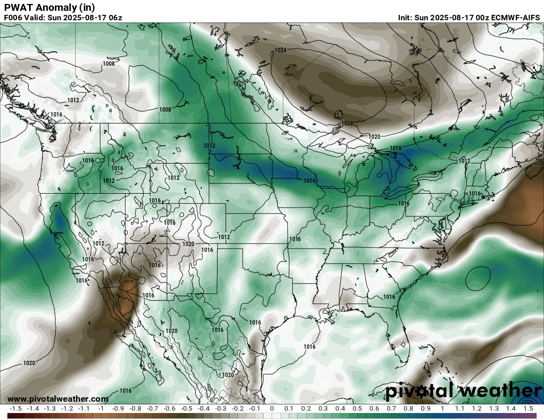
At least scattered thunderstorm activity is expected over much of the country today as an unusually moist atmosphere is in place in most locations. While not as organized as over the upper Midwest, some locally heavy rainfall could occur in other locations, especially the Northeast and Mid-Atlantic regions.
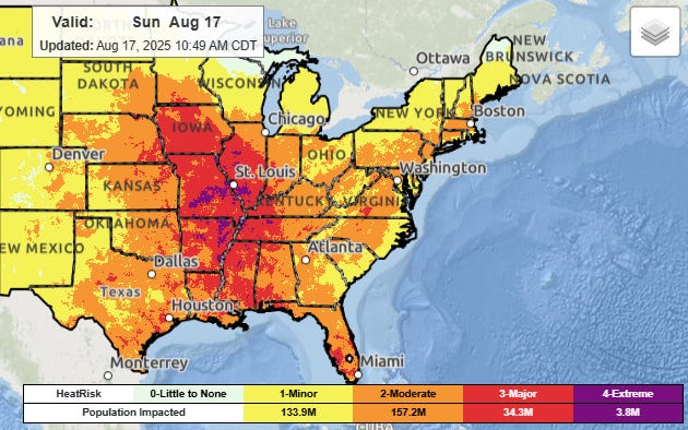
Heat and humidity will continue to plague much of the eastern United States, with moderate heat stress in most areas. A large swath of the middle of the nation along the Mississippi Valley will experience major to extreme heat risk this afternoon, and heat advisories are in effect for most of this area.

While not as extreme as much of last week, elevated fire danger concerns along with risks of dry, high based thunderstorms are forecast today in the Intermountain West. The National Interagency Fire Center this morning reported seven new large wildfires in the last 24 hours, with 52 such fires burning nationally. The national wildfire preparedness level continues at the second highest level. Unusually hot and dry weather, including some potential records, are expected over much of the western half of the country this week as another strong mid and upper level high pressure system builds over the region.