


Eastern Pacific remains active, Atlantic remains not
June 16, 2025 BalancedWx Tropical Newsletter

As anticipated, the eastern Pacific remained active over the last week, as Tropical Storm Dalila formed and brought heavy rainfall to the coast of southwest Mexico, and now the next system we talked about in last week’s newsletter is organizing to the west of Central America.
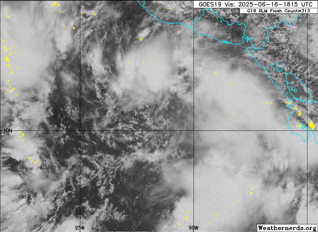
Invest 94E has been designated by the National Hurricane Center (NHC), and from visible satellite imagery looks to be organizing around a broad center of low pressure centered near 11N, 92W. In fact, NHC just issued their first advisory late this afternoon on this system as Potential Tropical Cyclone (PTC) Five-E.
As my colleague Michael Lowry pointed out in his excellent newsletter this morning, so far the eastern Pacific has been more about quantity than quality, as there have been four systems but only one - Barbara - briefly reached hurricane intensity. Future Erick may change that, however, as overall conditions look relatively favorable for intensification.
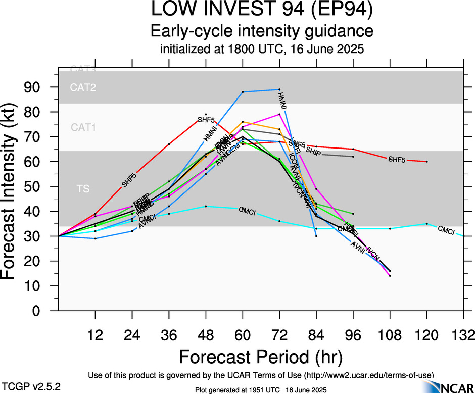
A consensus of the intensity models show a future Erick reaching a solid category 1 hurricane intensity, and a couple of the hurricane models show it reaching category 2 intensity. The system is also developing a bit farther southeast than the other systems so far in the eastern Pacific, and is forecast to move closer to the coast. In fact, it seems likely that a future Erick will become the first landfalling tropical cyclone of the 2025 season, with models implying a landfall somewhat in southern Mexico about 3 days from now.
![[Key Messages]](https://substackcdn.com/image/fetch/f_auto,q_auto:good,fl_progressive:steep/https%3A%2F%2Fsubstack-post-media.s3.amazonaws.com%2Fpublic%2Fimages%2F9d2c399c-078a-4169-a856-bf85f18209a3_897x736.png "[Key Messages]")
In its first advisory on PTC Five-E, NHC is forecasting it to make landfall in southern Mexico as a hurricane. This is obviously a system that will bear close watching as it could be a rather significant event for this region, and I will provide updates in my regular newsletters.
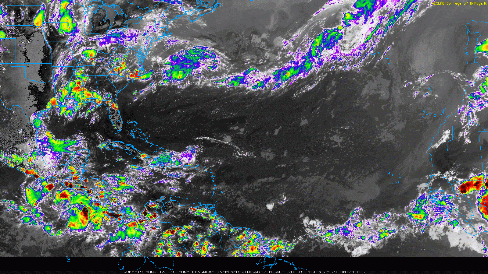
Turning to the Atlantic, there is not much going on except some periodic waves of Saharan dust propagating west across the tropical Atlantic. The Madden-Julian Oscillation, which as we discussed last week is a large scale tropical disturbance that can help make conditions more favorable for tropical cyclone formation, looks to remain very weak over the next 10 days. The American Global Ensemble Forecast System (GEFS) has started again to show some signs of development in the western Caribbean in about 7-10 days as the current favorable environment over the eastern Pacific expands a bit west. However, it has been doing this periodically for a couple of weeks now - as has occasionally the European ensemble - but as of now there has been no signs of this happening in the real atmosphere. Until there’s a more defined signal in either the models or the atmosphere, I would expect things to remain quiet in the Atlantic. Another system could develop though in the eastern Pacific after future Erick in that 7-10 day period.

Something that could be more of a concern on the Gulf coast of Mexico is enhanced rainfall from the remnants of future Erick and a weak disturbance coming up from the southeast. The latest ECMWF AI model 7-day rainfall forecast shows up to 300 mm (~12”) of rainfall along the Mexican Gulf coast south of Brownsville.
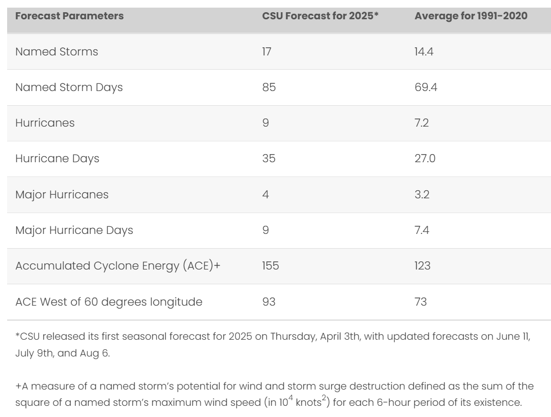
I mentioned in last week’s newsletter that the forecast team at Colorado State University would be releasing their updated seasonal hurricane forecast last week, and the update generally continued the same forecast as their initial release in early April. As shown in the table above, they continue to anticipate a somewhat above normal level of tropical cyclone activity in the Atlantic basin, in line with nearly all of the seasonal forecasts issued by public and private sector entities.