
Catastrophic flash flooding strikes another major camping area - this time outcomes seem more positive
Record rainfall and flooding hits Southeast Missouri during early morning hours of Friday
Hi everyone — apologies for the longer than planned delay in posting, but in addition to traveling, our family has been dealing with some unexpected issues the last day or so. There has been a major weather event back near my old stomping grounds though that I wanted to talk a bit about.
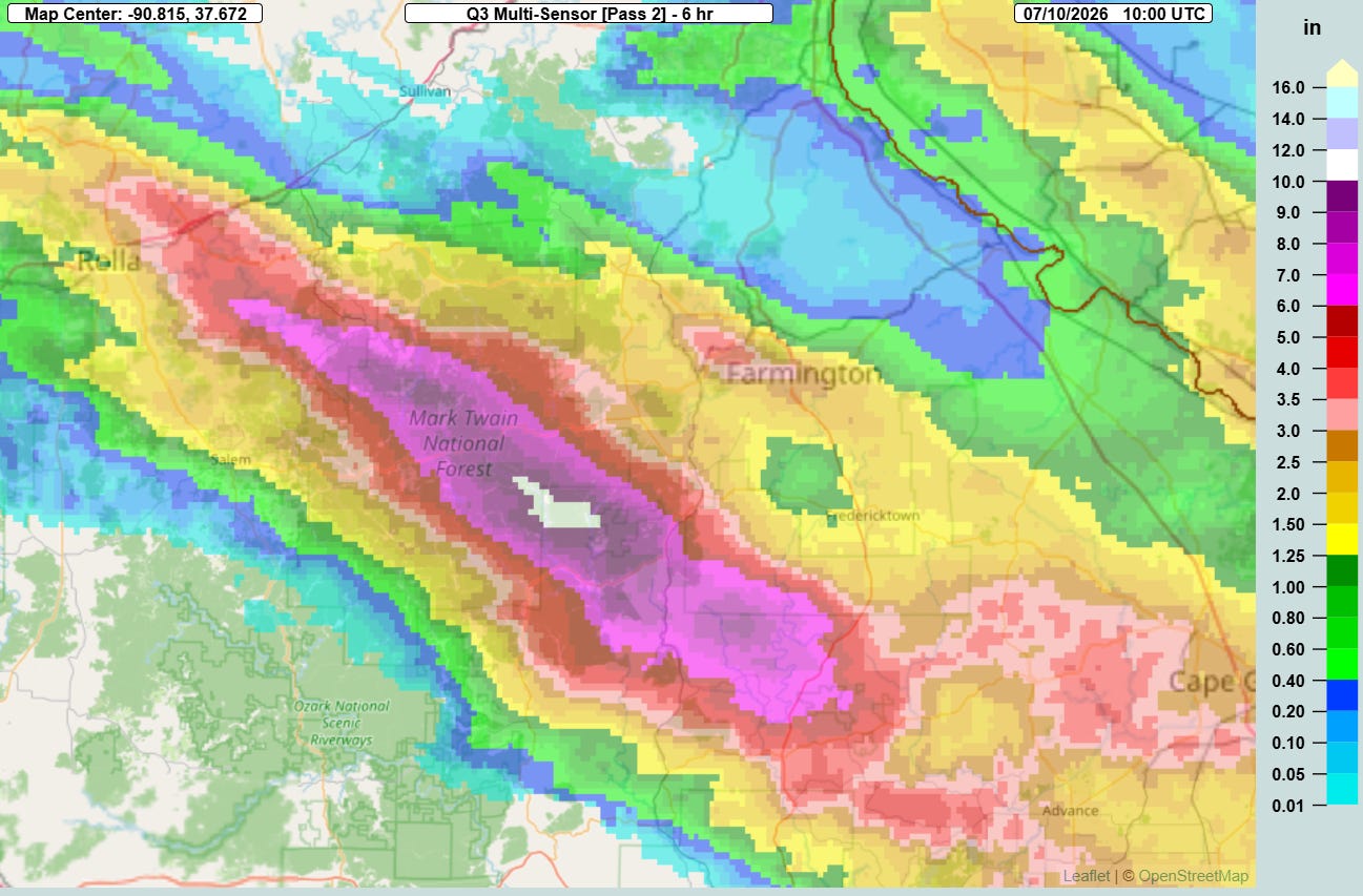
Once again, major flash flooding impacting campgrounds in the middle of the night is the story — but thankfully this time the outcome appears to have been a lot more positive. During the early morning hours Friday 6 to (crazily) as much as 12” of rain fell in just 6 hours along a rather broad swath from near Rolla to just west of Cape Girardeau in southeast Missouri due to training thunderstorms with torrential rainfall rates. This area is mainly part of the Mark Twain National Forest and is full of campgrounds, many of which are for young campers (I did Science Club camping in this region in high school).
While not quite as flash flood prone as an area like the Texas Hill Country, this is an area with rocky, hilly terrain and rivers and streams can go quickly from placid to raging floods. A number of river basins were impacted by this rainfall, including the Black River where the level at Annapolis which set a new record stage as it jumped from a base flow of 4’ to moderate flood stage of 15’ in just a matter of a few hours — and reached 28.73’ by midday, breaking the prior record by more than a foot (records go back to at least 1950).
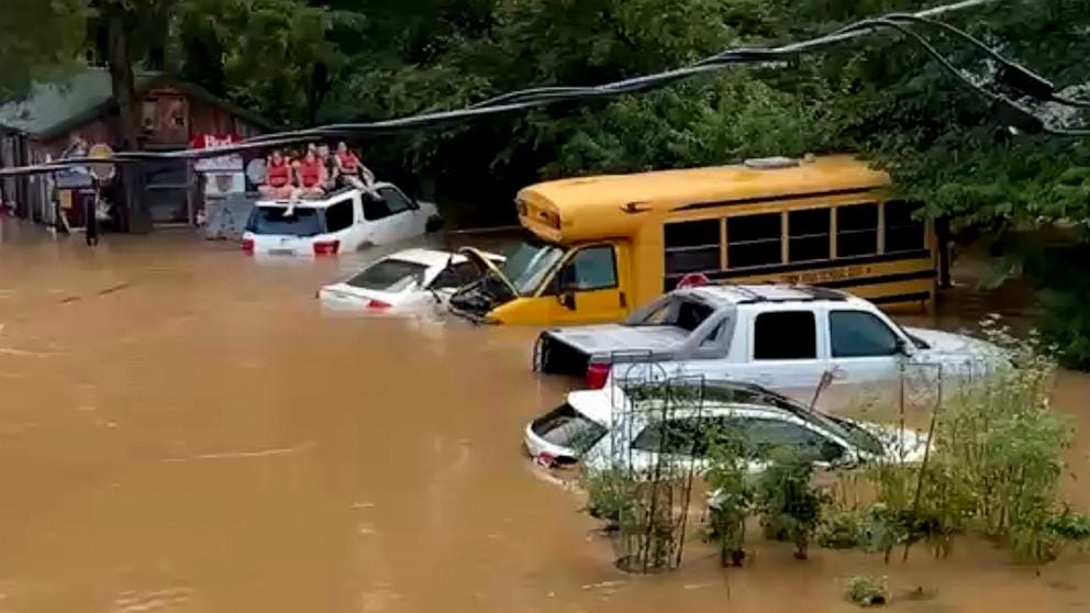
The result was many campgrounds being inundated during the early morning, and hundreds of people — including many children — having to rush to whatever safety they could find. While tragically there has been at least 1 fatality due to flash flooding in the region, it seems that nearly all of the campers made it to safety and there were no fatalities in those facilities. That is truly amazing, and of course stands in contrast to the horrible catastrophe along the Guadalupe River last July. The slower rise in the rivers in Missouri may have played some role — but hopefully we will also hear more about what sort of evacuation plans the Missouri campgrounds that might have helped improve the outcomes there.
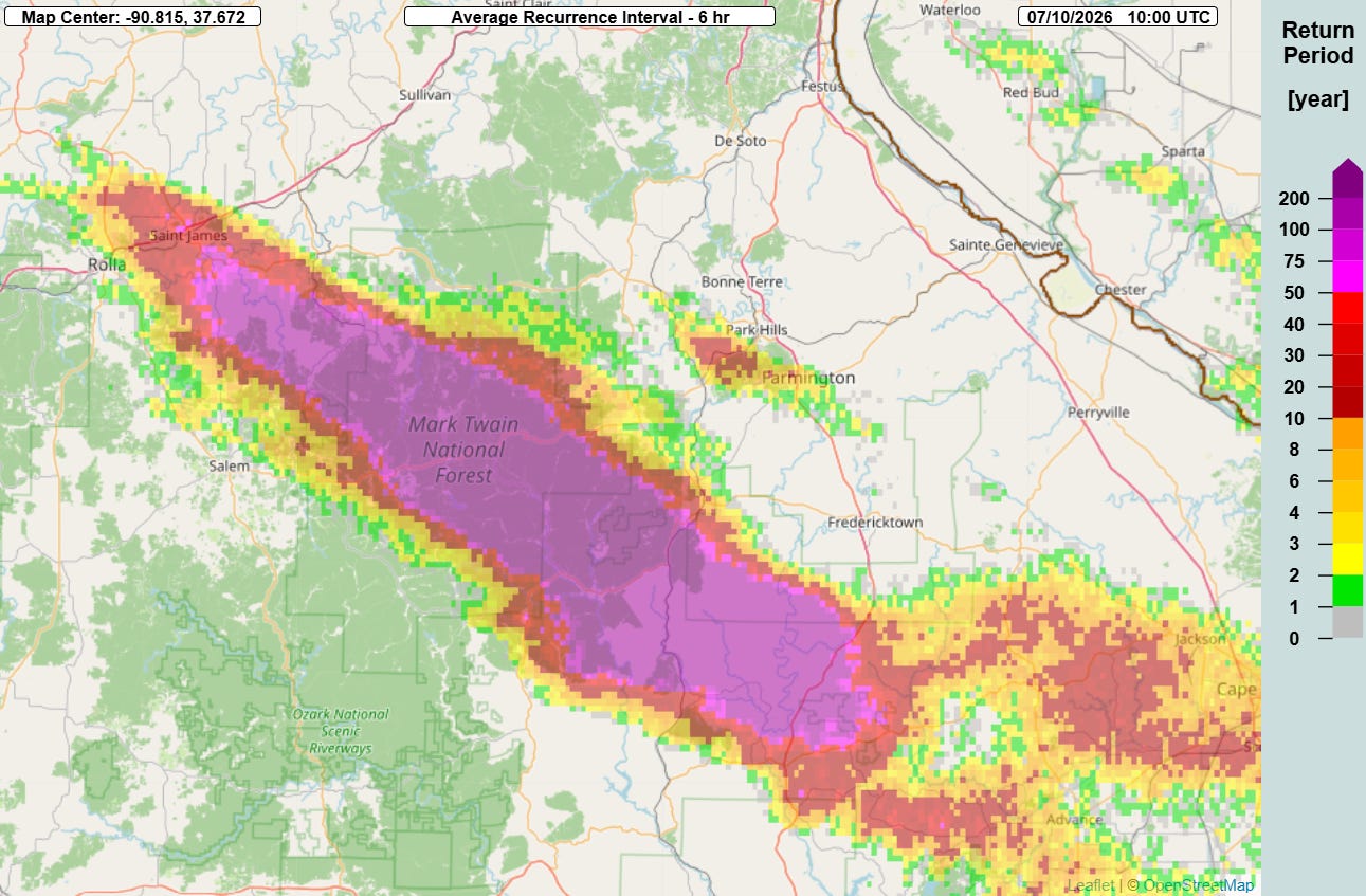
The Multi-radar Multi-sensor (MRMS) FLASH average recurrence interval for this rainfall showed that values off the chart, more than a 1 in 200 (.5%) event. The NWS in St. Louis estimated that this was a 1-in-1000 year rainfall event where the maximum rainfall occurred. Again, though, it is important to note that this is based on the most recent NOAA Atlas 14 rainfall frequency data and a stable climate. Our climate is not stable and all indications are that these sorts of rainfall events are happening with greater frequency — and I am going to keep repeating that I think that the weather and emergency management communities need to make improvement of flash flood forecasting and warnings through research and leveraging current technology a top priority.
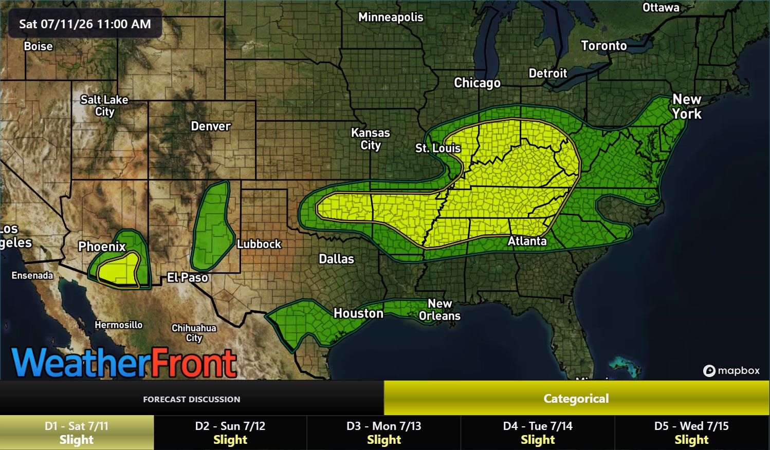
More flash flooding is possible tonight in the Ohio and Tennessee Valleys and parts of the Mid-South. Monsoonal moisture is starting to work into the Southwest, and a slight (level 2 of 4, yellow on the map) risk of flash flooding is also in place in southern Arizona.
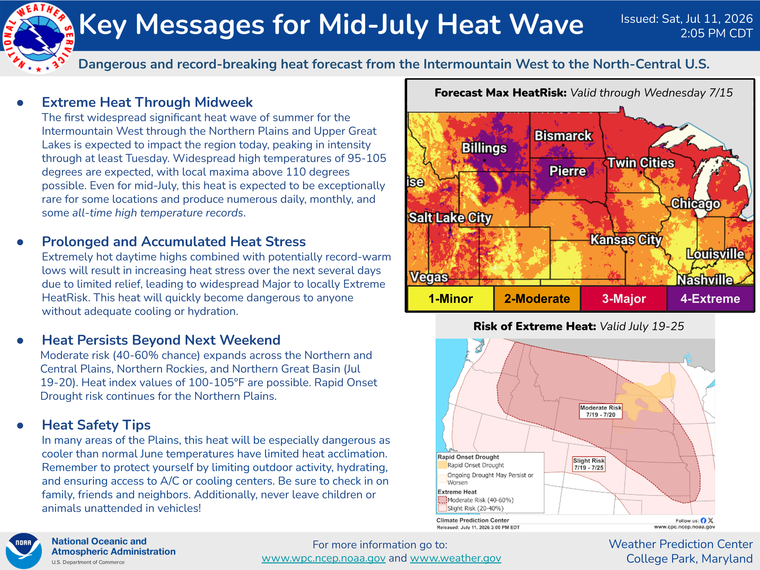
The intense upper level high pressure and associated heat wave is still on track for the north-central states and Intermountain West for the next several days, and it now appears that some all-time record high temperatures will fall. I will have more details on all of this in the next couple of days.
Programming note: posts will continue to be more sporadic than normal through the early part of next week.
Balanced Weather is made possible by the generous support of paid subscribers, who as thanks get access to live Balanced Weather chats and videos as well as the ability to post comments and ask questions on posts. To become a paid subscriber or a free subscriber (also very much appreciated and you will automatically receive new posts in your email), please click below.
The climate has never been "stable."
Climate science says the CO2 concentration became sufficient to affect earth's temperatures in 1957. So, here is a graph from 1880 to 1957. You'll see the mean temperature for earth was certainly not stable: https://www.woodfortrees.org/plot/hadcrut3gl/from:1880/to:1957