
Breaking: Flash flood emergencies in Kentucky as serious flash flooding strikes state
Utah declares state of emergency due to wildfires as Cottonwood Fire grows to near 100K acres, state fireworks ban issued
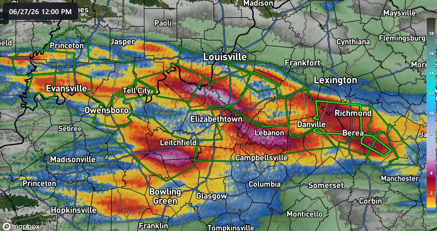
Busy day for me today, but I wanted to get out a quick newsletter with some short updates on several major weather stories. Thunderstorms with torrential rain have been training across much of the Ohio Valley the last 24 hours, with Kentucky particularly impacted. Over just the last 6 hours several bands of 4-8” of rain has occurred, and significant flash flooding has been reported with many roads and highways closed or impacted by high water.
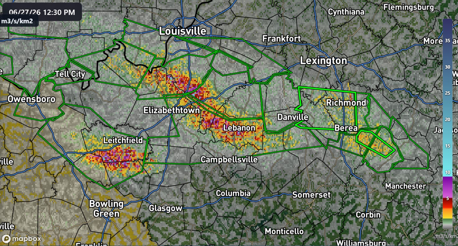
Flash flood emergencies — the highest level of NWS warning reserved for catastrophic flood impacts — are in effect in parts of eastern Kentucky around Richmond and Berea (bright green polygons on map above) where numerous water rescues have been reported. Recent MRMS FLASH unit streamflow inundation data (above) shows that at least as significant flooding impacts are likely occurring across central Kentucky from south of Louisville through Lebanon, and to the south of Leitchfield. Values of 10+ are scattered within this area which are correlated with serious flash flooding. WLKY-TV reports that life-threatening flooding is ongoing in parts of Bullitt and Spencer counties south of Louisville, with numerous water rescues and a report of a vehicle swept away by flood waters.
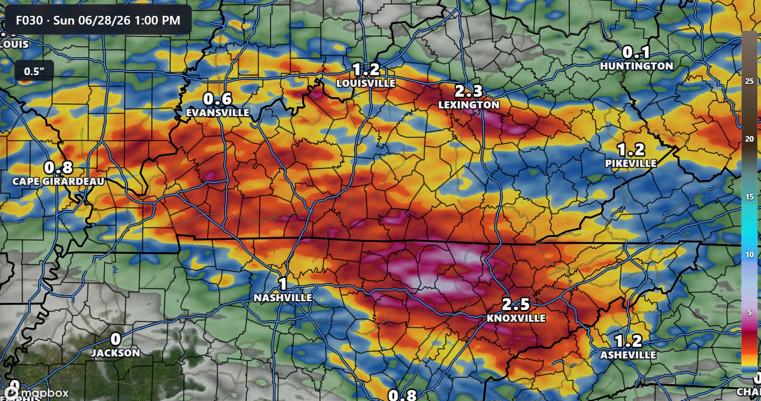
While rainfall has temporarily tapered off somewhat across the most heavily impacted areas, additional thunderstorms are developing upstream across the Mid-Mississippi Valley and expected to spread east across the Ohio and Tennessee Valleys through Sunday morning.
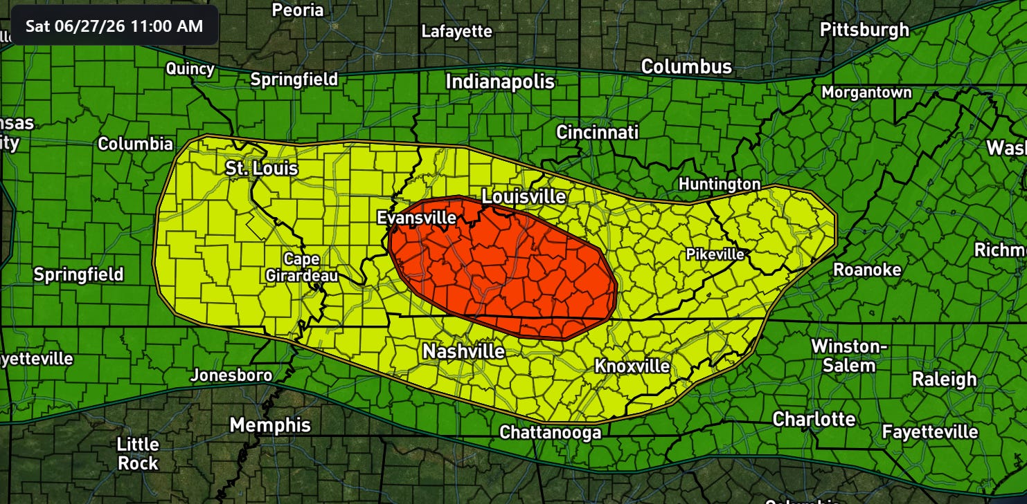
A moderate (level 3 of 4, red above) risk of flash flooding is in place from the Weather Prediction Center, and I would not be surprised to see that expanded a bit southeast into northern Tennessee based on the latest forecast rainfall from the morning high resolution ensemble models as shown above.
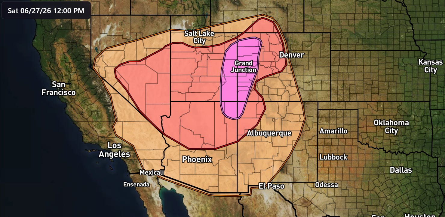
On the other end of the weather spectrum, another day of dangerous fire weather conditions is anticipated across the Southwest and Rockies today, with the Storm Prediction Center once again outlooking an extremely critical (level 3 of 3) fire danger area across the Four Corners region. Much of the Southwest will be experiencing elevated to critical fire danger with gusty winds and dry air in place.
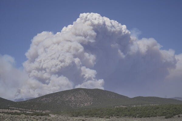
Numerous large wildfires are already burning across this region, and the extreme fire weather conditions allowed them to expand significantly in the last 24 hours and in some cases supported new wildfire starts. Utah is the state currently the most impacted, with the Cottonwood Fire having burned nearly 100K acres with 0% containment, and other large wildfires burning and spreading southwest of Salt Lake City. Numerous evacuation orders are in place, and the Governor has declared a state of emergency and issued a statewide ban on fireworks through July 5th. Widespread elevated to critical fire danger conditions are expected over much of the region again on Sunday.
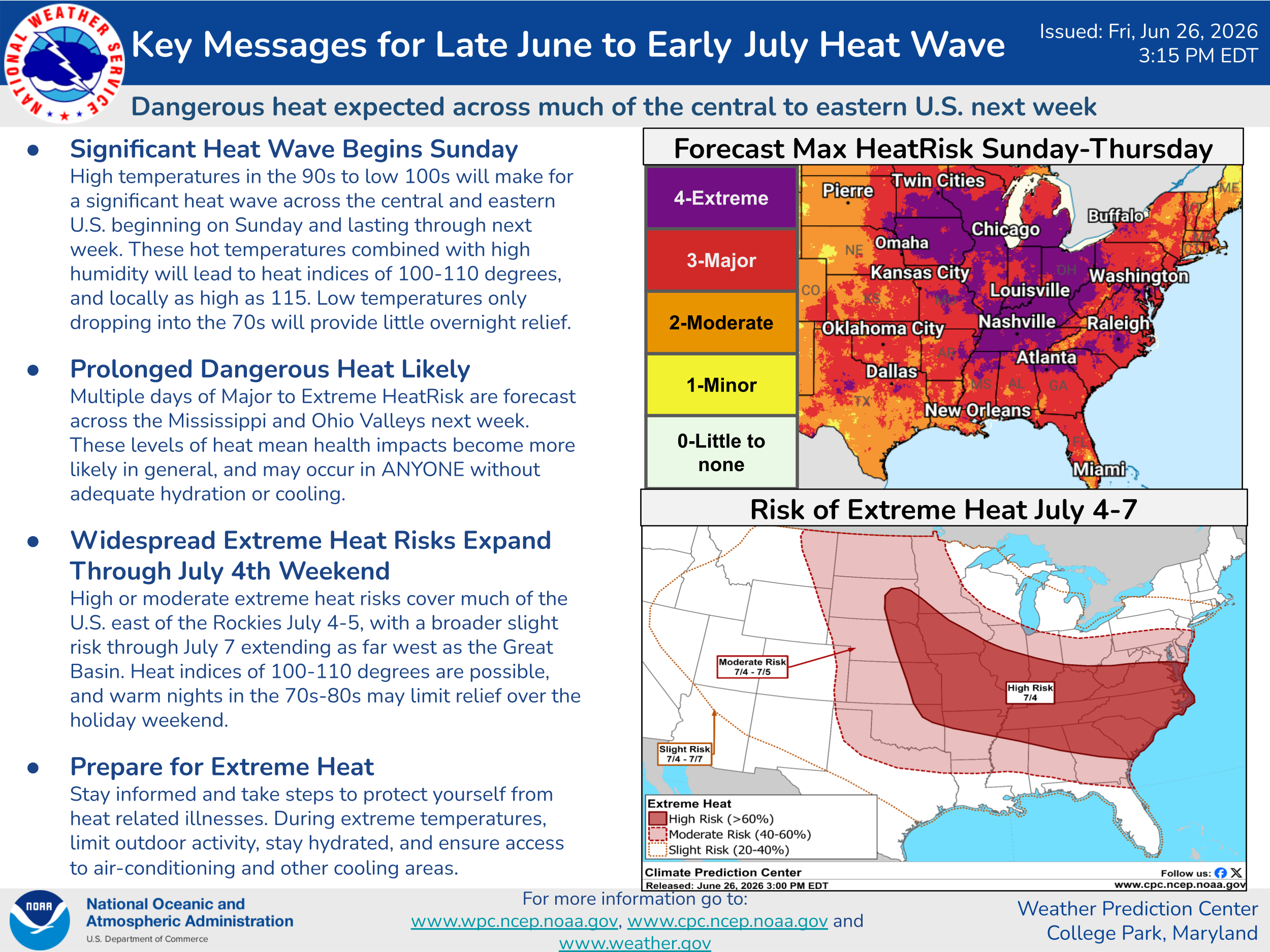
NWS offices in the Midwest have begun issuing extreme heat watches, warnings and advisories ahead of the anticipated major heatwave expected across much of the country east of the Rockies as the area expected to experience extreme heat risk has continued to expand. I will have more details on this later in the weekend.
Programming Reminder: Given the ongoing active weather, I am utilizing the Substack Chat feature to share periodic real-time updates. I also do occasional live videos to provide briefings and updates about the evolution of severe weather and flash flooding risks. As a reminder, these are benefits that paid subscribers receive for their support of Balanced Weather. Any videos I do will also be recorded and shared to all subscribers. I also provide updates on my BlueSky and Facebook feeds, and via occasional Substack Notes.
Balanced Weather is made possible by the generous support of paid subscribers, who as thanks get access to live Balanced Weather chats and videos as well as the ability to post comments and ask questions on posts. To become a paid subscriber or a free subscriber (also very much appreciated and you will automatically receive new posts in your email), please click below.