Active day in the Arklatex region
And disturbing security news about the national Doppler weather radar network
There’s plenty of weather to talk about today - but I feel compelled to start this morning’s newsletter with a very disturbing story that was reported by Andrew Freedman of CNN late yesterday. He reports that the FBI and other law enforcement agencies are actively investigating credible threats to the nation’s federal network of Doppler weather radars. The WSR-88D (Weather Surveillance Radar-1988 Doppler) or NEXRAD network consists of 160 radars jointly operated by the National Weather Service, the Department of Defense, and the Federal Aviation Administration. The network is managed by the Radar Operations Center (ROC), a tri-agency organization that is primarily run by NOAA/NWS and is based in Norman, OK.
I encourage you to read Andrew’s excellent story for more detail, but the bottom line is that e-mails were sent to NOAA offices yesterday outlining that the anti-government militia organization Veterans on Patrol views the NEXRAD network as “weather weapons,” and was discussing techniques for destroying radar sites. Several encounters with Veterans on Patrol members have been reported by NOAA security, and NOAA personnel have been advised to not travel to remote radar sites alone and to be alert for suspicious activity. The National Severe Storms Laboratory and ROC have a joint facility known as North Base at Max Westheimer Airport in Norman that includes several radar facilities. My understanding from colleagues is that these threats have periodically resulted in changes to work schedules in the last week or two for employees that ordinarily work at North Base.
Needless to say, this would be a disturbing development at any time, but during a time when NWS employees are already dealing with significant staffing shortages and budget and administrative obstacles, this is particularly challenging. It should go without saying that the NEXRAD radars are of course not “weather weapons,” and have been extensively studied for decades to ensure that they are safe to the public and the staff that work near them. Not only do NWS meteorologists rely on these radar for issuing severe weather and flash flood warning, the entire national transportation system and economy rely on these radars to provide critical weather information. Hopefully the law enforcement investigation will get to the bottom of this particular situation quickly, but this is yet another example of the challenges that federal science agencies are dealing with in our current environment.
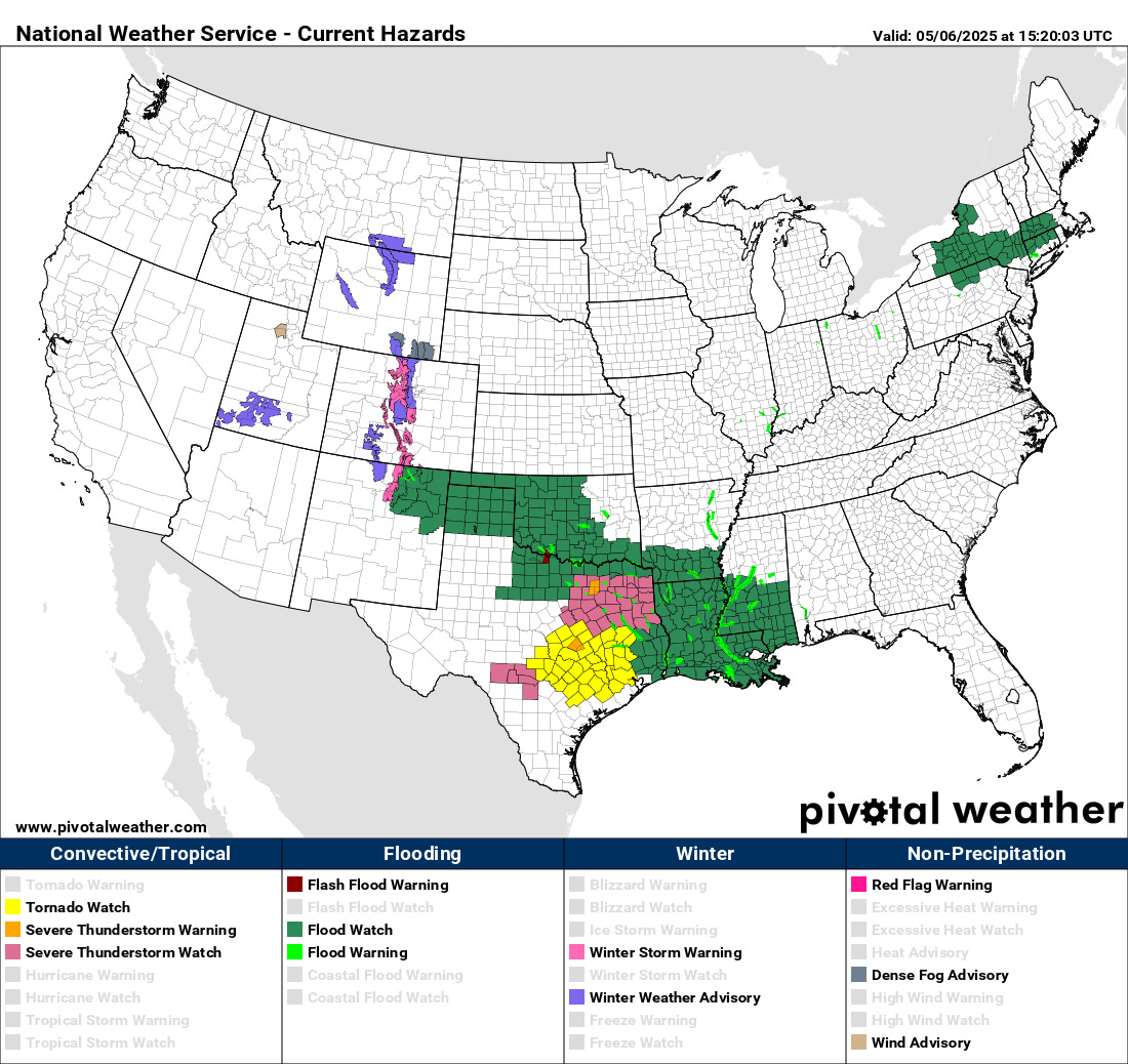
Let’s get to talking about the weather. Today’s focus will be in the south central US. As anticipated, scattered severe storms developed last evening in southeast New Mexico and west Texas, and evolved into a cluster of strong to severe storms that has now moved into northern and central Texas. Tornado and severe thunderstorm watches are in effect with these complex of storms as shown above.
The weather setup for today across this region is quite complex. On a large scale, conditions are favorable for severe supercells storms capable of large hail, damaging winds and potentially strong tornadoes. A warm front along the Gulf Coast is slowly moving north with very moist and increasingly unstable air while the storms are slowly moving east. The exact evolution of the storms, how quickly they move east, and how far north the warm front gets before the storms arrive will all play a critical role in the magnitude of the severe weather risk and where it is maximized.
As of their morning outlook, SPC had an enhanced (level 3 of 5) risk across southeast Texas and southwest Louisiana. Some of the most recent model and observational data suggests the higher severe weather probabilities could extend a bit farther north than the current outlook suggests. Additionally, in the wake of this morning’s activity, an additional band of severe storms capable of producing very large hail is likely to develop back to the west along the actual cold front over central and northwest Texas.

In addition to the severe weather risk, flash flooding will also be a significant concern today, and the Weather Prediction Center has a large area from eastern Texas to southern Mississippi in a moderate (level 3 of 4) risk of flash flooding today into tonight. The morning High Resolution Ensemble Forecast (HREF) system suggests that bands of 5-7” of rain will be common across this region, and given recent heavy rainfall in parts of this area, numerous incidences of flash flooding will be likely.
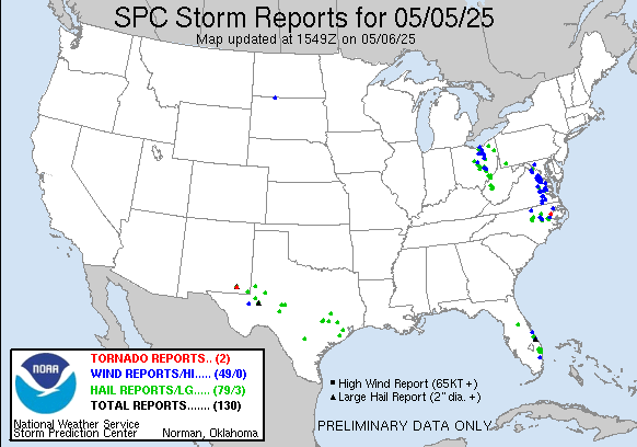
Severe weather and flash flooding will also be a concern in the Northeast with the eastern upper level low pressure system we have been talking about the last several days. This system produced a number of reports of severe weather yesterday in the Mid Atlantic and eastern Great Lakes regions. While this system is weakening a bit now, it will still be producing thunderstorms over the Northeast today that could produce localized severe weather and/or flash flooding as seen in the SPC and WPC outlooks above.

As we have been discussing the last several days, the upper level low pressure system responsible for the weather over the southern US looks as if it will drift east and southeast to along the Gulf Coast and take up residence for several days. This will mean a number of days of scattered to numerous thunderstorms for the Southeast. While not a high end severe weather risk setup, there certainly could be isolated strong to severe thunderstorms as shown in the CSU machine learning probabilities above. Meanwhile, the western United States will see a large area of high pressure aloft develop, bringing warmer and drier weather, and potentially even some record high temperatures by this weekend.


